Area Overview for BA14 6AG
Photos of BA14 6AG
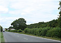
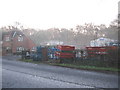
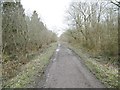
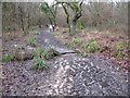
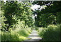
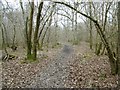
10 photos from this area
Area Information
Key information about the BA14 6AG including its size, population, and administrative classification.
- Area Type
- Postcode
- Area Size
- 16.8 hectares
- Population
- 1460
- Population Density
- 393 people/km²
House Prices in BA14 6AG
36
Properties
£284,417
Average Sold Price
£116,000
Lowest Price
£635,000
Highest Price
Showing 36 properties
| Address | Type | Beds | Baths | Last Sale Price | Last Sale Date | |
|---|---|---|---|---|---|---|
| York Villa, 18 Westbury Road, Yarnbrook, BA14 6AG | Detached | 5 | 2 | £365,000 | Dec 2024 | |
| 29 Westbury Road, Yarnbrook, BA14 6AG | Detached | 6 | 3 | £635,000 | Oct 2024 | |
| 30 Westbury Road, Yarnbrook, BA14 6AG | Semi-detached | 3 | 1 | £330,000 | Sep 2023 | |
| 25 Westbury Road, Yarnbrook, BA14 6AG | Terraced | 2 | 1 | £290,000 | Mar 2023 | |
| 39 Westbury Road, Yarnbrook, BA14 6AG | Detached | 3 | 2 | £407,500 | Nov 2022 | |
| 51 Westbury Road, Yarnbrook, BA14 6AG | house | - | - | £280,000 | Jan 2022 | |
| 22 Westbury Road, Yarnbrook, BA14 6AG | house | - | - | £136,000 | May 2021 | |
| 31 Westbury Road, Yarnbrook, BA14 6AG | house | - | - | £240,000 | Jan 2021 | |
| 42 Westbury Road, Yarnbrook, BA14 6AG | house | - | - | £237,500 | Dec 2020 | |
| 34 Westbury Road, Yarnbrook, BA14 6AG | house | - | - | £163,000 | Jul 2020 |
Page 1 of 4
Energy Efficiency in BA14 6AG
Amenities
Schools
| Rank | School | Type | Entry gender | Ages |
|---|
Explore more schools in this area
Go to Schools tabDemographics
Household Size
Two person
most common
Accommodation Type
Houses
most common
Tenure
86
majority
Ethnic Group
White
most common
Religion
N/A
most common
Household Composition
N/A
most common
Age
47
median
Adults (30-64 years)
most common
Household Deprivation
N/A
with no deprivation
NS-SEC
34
in Lower managerial occupations
Explore more demographic insights in this area
Go to Demographics tabPlanning
Planning Constraints
- Flood RiskPremium
- Ramsar Wetland SitesPremium
- Area of Outstanding Natural BeautyPremium
- Protected Nature ReservePremium
- Protected WoodlandPremium