Area Overview for BA14 0UB
Photos of BA14 0UB
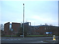
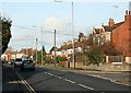
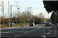
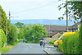
9 photos from this area
Area Information
Key information about the BA14 0UB including its size, population, and administrative classification.
- Area Type
- Postcode
- Area Size
- 1.2 hectares
- Population
- 1445
- Population Density
- 3827 people/km²
House Prices in BA14 0UB
35
Properties
£138,033
Average Sold Price
£45,950
Lowest Price
£257,500
Highest Price
Showing 35 properties
| Address | Type | Beds | Baths | Last Sale Price | Last Sale Date | |
|---|---|---|---|---|---|---|
| 28 Liddington Way, Trowbridge, BA14 0UB | Terraced | 2 | 1 | £215,000 | Jan 2025 | |
| 16 Liddington Way, Trowbridge, BA14 0UB | Terraced | 2 | - | £198,000 | Nov 2023 | |
| 34 Liddington Way, Trowbridge, BA14 0UB | Terraced | 2 | 1 | £180,000 | May 2020 | |
| 3 Liddington Way, Trowbridge, BA14 0UB | Detached | 5 | 1 | £257,500 | Sep 2017 | |
| 5 Liddington Way, Trowbridge, BA14 0UB | Detached | 3 | - | £222,000 | Apr 2016 | |
| 26 Liddington Way, Trowbridge, BA14 0UB | Terraced | 2 | - | £164,000 | Nov 2014 | |
| 19 Liddington Way, Trowbridge, BA14 0UB | Terraced | 2 | - | £125,000 | Apr 2014 | |
| 34A Liddington Way, Trowbridge, BA14 0UB | house | 2 | - | £131,350 | Apr 2014 | |
| 9 Liddington Way, Trowbridge, BA14 0UB | Detached | 4 | - | £225,000 | Nov 2013 | |
| 21 Liddington Way, Trowbridge, BA14 0UB | Terraced | 2 | - | £122,500 | Jul 2013 |
Page 1 of 4
Energy Efficiency in BA14 0UB
Amenities
Schools
| Rank | School | Type | Entry gender | Ages |
|---|
Explore more schools in this area
Go to Schools tabDemographics
Household Size
Two person
most common
Accommodation Type
Houses
most common
Tenure
79
majority
Ethnic Group
White
most common
Religion
N/A
most common
Household Composition
N/A
most common
Age
47
median
Adults (30-64 years)
most common
Household Deprivation
N/A
with no deprivation
NS-SEC
33
in Lower managerial occupations
Explore more demographic insights in this area
Go to Demographics tabPlanning
Planning Constraints
- Flood RiskPremium
- Ramsar Wetland SitesPremium
- Area of Outstanding Natural BeautyPremium
- Protected Nature ReservePremium
- Protected WoodlandPremium