Area Overview for BA14 0SA
Photos of BA14 0SA
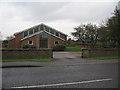
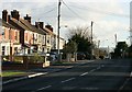
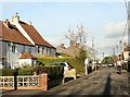
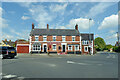
32 photos from this area
Area Information
Key information about the BA14 0SA including its size, population, and administrative classification.
- Area Type
- Postcode
- Area Size
- 9.3 hectares
- Population
- 1460
- Population Density
- 393 people/km²
House Prices in BA14 0SA
40
Properties
£329,622
Average Sold Price
£169,000
Lowest Price
£520,000
Highest Price
Showing 40 properties
| Address | Type | Beds | Baths | Last Sale Price | Last Sale Date | |
|---|---|---|---|---|---|---|
| 59 Woodmarsh, North Bradley, BA14 0SA | Detached | 5 | 3 | £430,000 | Jul 2025 | |
| 55 Woodmarsh, North Bradley, BA14 0SA | Semi-detached | 2 | 1 | £245,000 | Nov 2024 | |
| 49 Woodmarsh, North Bradley, BA14 0SA | house | - | - | £520,000 | Oct 2024 | |
| Homeleigh, 41 Woodmarsh, North Bradley, BA14 0SA | house | - | - | £325,000 | Aug 2021 | |
| 29 Woodmarsh, North Bradley, BA14 0SA | Detached | 4 | 2 | £330,000 | Jan 2019 | |
| 39 Woodmarsh, North Bradley, BA14 0SA | Detached | 4 | 2 | £405,000 | Jan 2017 | |
| 9 Woodmarsh, North Bradley, BA14 0SA | Bungalow | 4 | 2 | £375,000 | Jul 2016 | |
| 47 Woodmarsh, North Bradley, BA14 0SA | house | - | - | £375,000 | Sep 2015 | |
| 57 Woodmarsh, North Bradley, BA14 0SA | Semi-detached | 2 | - | £169,000 | Apr 2015 | |
| 43 Woodmarsh, North Bradley, BA14 0SA | house | - | - | £212,000 | Dec 2013 |
Page 1 of 4
Energy Efficiency in BA14 0SA
Amenities
Schools
| Rank | School | Type | Entry gender | Ages |
|---|
Explore more schools in this area
Go to Schools tabDemographics
Household Size
Two person
most common
Accommodation Type
Houses
most common
Tenure
86
majority
Ethnic Group
White
most common
Religion
N/A
most common
Household Composition
N/A
most common
Age
47
median
Adults (30-64 years)
most common
Household Deprivation
N/A
with no deprivation
NS-SEC
34
in Lower managerial occupations
Explore more demographic insights in this area
Go to Demographics tabPlanning
Planning Constraints
- Flood RiskPremium
- Ramsar Wetland SitesPremium
- Area of Outstanding Natural BeautyPremium
- Protected Nature ReservePremium
- Protected WoodlandPremium