Area Overview for BA14 0RA
Photos of BA14 0RA
Area Information
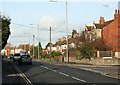
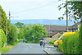
BA14 0RA is a specific postcode area covering a small residential cluster within the town of Trowbridge, Wiltshire. This cluster encompasses 6,616 square metres, holding a population of 1,445 residents. The area sits in the low-lying claylands of the Bristol Avon, astride the River Biss which cuts through the Trowbridge Anticline. This geological formation provides better-drained soil than the surrounding clay, historically influencing settlement patterns. Living in BA14 0RA means residing in a location that serves as part of Wiltshire's administrative heart. The town became the county town in 1889, chosen specifically for its railway connections that allowed representatives from Swindon and Salisbury to commute efficiently. The postal sector reflects a compact living environment where daily life revolves around the historic density of the village centre. As a residential cluster, the area offers a fixed footprint within the larger town plan, providing residents with a defined sense of locality while remaining integrated into the broader fabric of Wiltshire.
- Area Type
- Postcode
- Area Size
- 6616 m²
- Population
- 1445
- Population Density
- 3827 people/km²
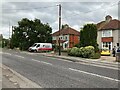
This postcode represents a small residential cluster where Houses form the primary accommodation type. The overall home ownership figure for the region reaches 79%, indicating that this is overwhelmingly an owner-occupied area rather than a rental market. Within BA14 0RA specifically, the inventory consists of Houses, consistent with the town's layout and historical development. You will find very few purpose-built flats or large-scale new-build developments in this specific square mile. The market here is driven by established stock that has been lived in for decades. Prospective buyers looking at homes in BA14 0RA should expect to compete with other owners for existing properties. The high proportion of owners means depreciation is generally low, and maintenance standards tend to be steady. This environment is less dynamic than urban property markets where new launches frequently appear. If you cannot find a suitable property directly within this 6,616 square-metre cluster, you must look toward the wider BA14 postcodes covering Trowbridge immediately beyond your initial search radius. The housing stock is defined by the practical reality of a specific residential cluster within a historic county town.
House Prices in BA14 0RA
Showing 7 properties
| Address | Type | Beds | Baths | Last Sale Price | Last Sale Date | |
|---|---|---|---|---|---|---|
| 74 Bradley Road, Trowbridge, BA14 0RA | Bungalow | 4 | 2 | £450,000 | Oct 2024 | |
| 64 Bradley Road, Trowbridge, BA14 0RA | Chalet | 3 | 3 | £200,000 | Jan 2006 | |
| 72 Bradley Road, Trowbridge, BA14 0RA | Detached | - | - | £105,000 | Nov 1999 | |
| 68 Bradley Road, Trowbridge, BA14 0RA | Detached | - | - | £87,000 | Mar 1997 | |
| 64A Bradley Road, Trowbridge, BA14 0RA | Bungalow | - | - | - | - | |
| 66 Bradley Road, Trowbridge, BA14 0RA | Detached | - | - | - | - | |
| 70 Bradley Road, Trowbridge, BA14 0RA | Detached | - | - | - | - |
Energy Efficiency in BA14 0RA
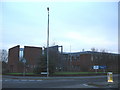
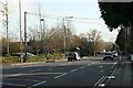
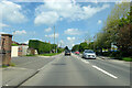
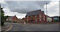
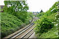
Daily life in BA14 0RA is centred around practical convenience within the town of Trowbridge. Local retail options are accessible, with Alibaba, Morrisons Daily, and Tesco Trowbridge located within practical reach. These supermarkets provide essential shopping for groceries and household necessities without the need for long journeys. Transport links are well supported by rail services that connect to Trowbridge Railway Station, Westbury Railway Station, and Bradford. Residents benefit from the historical positioning of the town as a central node for travel across Wiltshire. While specific dining or entertainment venues are not detailed in the immediate cluster data, the town centre hosts amenities ranging from local cafes to the Castle Place Shopping Centre built on the former castle site. The Limes, formerly Hall's Place, stands as a public park established through the reuse of a private residence in the late 19th century. Living in this small residential cluster means you access the broader town's resources while residing in a quieter, defined neighbourhood. The presence of County Hall and the local museum ensures there is cultural infrastructure nearby for those who appreciate history.
Amenities
Schools
| Rank | School | Type | Entry gender | Ages |
|---|
Explore more schools in this area
Go to Schools tabDemographics
The community in BA14 0RA reflects a settled population with a median age of 47 years. Adults between 30 and 64 years constitute the most common age range, indicating a mature demographic profile. Home ownership stands at 79%, showing that the vast majority of residents own their properties outright or via a mortgage rather than renting. This high level of tenure suggests stability within the neighbourhood. The accommodation type is predominantly households with Houses, rather than flats or terraced homes, aligning with the town's historical wooden-framed and stone construction styles. The predominant ethnic group is White, mirroring the broad demographic trends often found across rural Wiltshire. Such a profile rarely suits young families seeking starter homes or students looking for rentals. Instead, the area caters to established households seeking long-term stability. High ownership and an older median age typically correlate with lower turnover rates and a quiet, predictable community atmosphere. When buying homes in BA14 0RA, you are entering a market defined by permanence rather than transient occupancy.
Household Size
Accommodation Type
Tenure
Ethnic Group
Religion
Household Composition
Age
Household Deprivation
NS-SEC
Explore more demographic insights in this area
Go to Demographics tabPlanning
Planning Constraints
- Flood RiskPremium
- Ramsar Wetland SitesPremium
- Area of Outstanding Natural BeautyPremium
- Protected Nature ReservePremium
- Protected WoodlandPremium