Area Overview for BA14 0PU
Photos of BA14 0PU
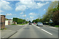
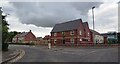
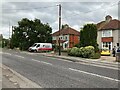
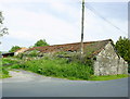
9 photos from this area
Area Information
Key information about the BA14 0PU including its size, population, and administrative classification.
- Area Type
- Postcode
- Area Size
- 1.5 hectares
- Population
- 1786
- Population Density
- 5427 people/km²
House Prices in BA14 0PU
44
Properties
£165,489
Average Sold Price
£48,500
Lowest Price
£312,500
Highest Price
Showing 44 properties
| Address | Type | Beds | Baths | Last Sale Price | Last Sale Date | |
|---|---|---|---|---|---|---|
| 34 Wilton Drive, Trowbridge, BA14 0PU | house | 4 | 2 | £288,500 | Jul 2025 | |
| 4 Wilton Drive, Trowbridge, BA14 0PU | Terraced | 3 | 1 | £270,000 | Jul 2025 | |
| 15 Wilton Drive, Trowbridge, BA14 0PU | Semi-detached | 5 | 2 | £312,500 | Feb 2025 | |
| 36 Wilton Drive, Trowbridge, BA14 0PU | Semi-detached | 3 | 1 | £252,000 | Apr 2024 | |
| 11 Wilton Drive, Trowbridge, BA14 0PU | house | - | - | £250,000 | Aug 2022 | |
| 22 Wilton Drive, Trowbridge, BA14 0PU | house | 3 | - | £235,000 | Jun 2021 | |
| 21 Wilton Drive, Trowbridge, BA14 0PU | house | - | - | £226,000 | Oct 2019 | |
| 2 Wilton Drive, Trowbridge, BA14 0PU | house | - | - | £162,500 | Dec 2017 | |
| 43 Wilton Drive, Trowbridge, BA14 0PU | Semi-detached | 3 | 1 | £180,500 | Oct 2017 | |
| 38 Wilton Drive, Trowbridge, BA14 0PU | Semi-detached | 4 | 2 | £238,000 | Sep 2016 |
Page 1 of 5
Energy Efficiency in BA14 0PU
Amenities
Schools
| Rank | School | Type | Entry gender | Ages |
|---|
Explore more schools in this area
Go to Schools tabDemographics
Household Size
Family (3-5 people)
most common
Accommodation Type
Houses
most common
Tenure
83
majority
Ethnic Group
White
most common
Religion
N/A
most common
Household Composition
N/A
most common
Age
47
median
Adults (30-64 years)
most common
Household Deprivation
N/A
with no deprivation
NS-SEC
30
in Lower managerial occupations
Explore more demographic insights in this area
Go to Demographics tabPlanning
Planning Constraints
- Flood RiskPremium
- Ramsar Wetland SitesPremium
- Area of Outstanding Natural BeautyPremium
- Protected Nature ReservePremium
- Protected WoodlandPremium