Area Overview for BA14 0PA
Photos of BA14 0PA
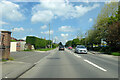
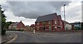
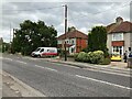
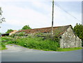
9 photos from this area
Area Information
Key information about the BA14 0PA including its size, population, and administrative classification.
- Area Type
- Postcode
- Area Size
- 1.8 hectares
- Population
- 2407
- Population Density
- 5739 people/km²
House Prices in BA14 0PA
46
Properties
£158,888
Average Sold Price
£44,500
Lowest Price
£245,000
Highest Price
Showing 46 properties
| Address | Type | Beds | Baths | Last Sale Price | Last Sale Date | |
|---|---|---|---|---|---|---|
| 31 Ashmead, Trowbridge, BA14 0PA | Terraced | 3 | 1 | £245,000 | Jul 2025 | |
| 73 Ashmead, Trowbridge, BA14 0PA | Terraced | 3 | 2 | £235,000 | Jun 2022 | |
| 7 Ashmead, Trowbridge, BA14 0PA | house | - | - | £104,200 | Jan 2022 | |
| 79 Ashmead, Trowbridge, BA14 0PA | house | - | - | £175,000 | Nov 2021 | |
| 83 Ashmead, Trowbridge, BA14 0PA | Semi-detached | 3 | 2 | £231,500 | Mar 2019 | |
| 25 Ashmead, Trowbridge, BA14 0PA | Terraced | 3 | - | £138,000 | Feb 2015 | |
| 77 Ashmead, Trowbridge, BA14 0PA | Terraced | 3 | - | £142,950 | Oct 2014 | |
| 29 Ashmead, Trowbridge, BA14 0PA | Terraced | - | - | £125,000 | May 2012 | |
| 85 Ashmead, Trowbridge, BA14 0PA | house | - | - | £162,500 | Mar 2011 | |
| 87 Ashmead, Trowbridge, BA14 0PA | Semi-detached | - | - | £150,000 | Mar 2008 |
Page 1 of 5
Energy Efficiency in BA14 0PA
Amenities
Schools
| Rank | School | Type | Entry gender | Ages |
|---|
Explore more schools in this area
Go to Schools tabDemographics
Household Size
Family (3-5 people)
most common
Accommodation Type
Houses
most common
Tenure
50
majority
Ethnic Group
White
most common
Religion
N/A
most common
Household Composition
N/A
most common
Age
47
median
Adults (30-64 years)
most common
Household Deprivation
N/A
with no deprivation
NS-SEC
23
in Lower managerial occupations
Explore more demographic insights in this area
Go to Demographics tabPlanning
Planning Constraints
- Flood RiskPremium
- Ramsar Wetland SitesPremium
- Area of Outstanding Natural BeautyPremium
- Protected Nature ReservePremium
- Protected WoodlandPremium