Area Overview for BA14 0LF
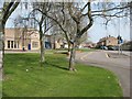
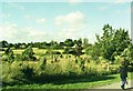
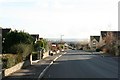
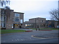
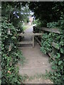
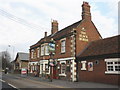
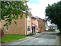
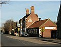
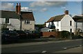
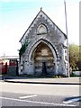
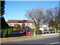
Photos of BA14 0LF

Area Information
Living in BA14 0LF means residing within a compact settlement of just 1.1 hectares in the town of Trowbridge. This postcode covers a specific residential cluster with a population of 1,179 people. The area sits in the low-lying claylands of the Bristol Avon, part of a historic ridge known as the Trowbridge Anticline. The soil here is notably better-drained than the surrounding land due to Cornbrash limestone. Historically, this location was chosen because the River Biss cut through the ridge, creating a natural crossing point that attracted settlement centuries ago. Trowbridge became the county town of Wiltshire in 1889, chosen specifically for its railway connections to Swindon and Salisbury. You will find yourself in an area where history meets modern convenience. The settlement's name comes from an ancient tree bridge, yet today it functions as a practical hub for local life with strong administrative roots. County Hall still serves as the seat of Wiltshire County Council on the town's outskirts. This postcode offers a grounded existence for those who prefer a defined neighbourhood rather than sprawling suburbs. The area retains a character shaped by its industrial past as a centre for woollen cloth production. Homebuyers here benefit from a known administrative status and a clear sense of place rooted in centuries of development.
- Area Type
- Postcode
- Area Size
- 1.1 hectares
- Population
- 1179
- Population Density
- 3420 people/km²
You will find that the housing stock in BA14 0LF is primarily composed of houses rather than flats or apartments. This type dominates the local landscape, consistent with the pattern found across the wider town. Home ownership stands at an impressive 72%, making this a strongly owner-occupied area. Very few residents rely on private or social renting within this postcode. The mix of accommodation types is straightforward, with houses forming the total picture of available homes. This high rate of ownership typically means a stable community with established residents. Buyers looking for properties here should expect traditional housing structures over modern complexes. The area represents a traditional model of residential living where families and individuals have invested in their own dwellings. This market segment appeals to those seeking permanence rather than the lifestyle of a renting household. The small size of the area, at 1.1 hectares, limits the total number of new developments. Existing properties hold more value as the land is largely consumed by current housing. Prospective buyers gain access to a mature market where the stock has been defined for decades. The dominance of houses supports a neighbourhood feel rather than a high-density urban experience.
House Prices in BA14 0LF
No properties found in this postcode.
Energy Efficiency in BA14 0LF
Your daily life in BA14 0LF is supported by a range of amenities within practical reach. Five retail locations serve the area, including Tesco Trowbridge, Aldi North, and Morrisons Daily. These supermarkets ensure you can complete weekly grocery shopping without leaving the town. Five rail-related facilities connect you to broader networks, with Trowbridge, Bradford, and Westbury Railway Station listed as key access points. This rail proximity facilitates travel to Salisbury and Swindon, leveraging the historical connections that made the town a county seat. The town centre features the Castle Place Shopping Centre, built on the site of the former castle. You can find dining options nearby, satisfied by the presence of a brewery established by Thomas Usher in 1824. A public park was established in the 1880s from the grounds of a former private house known as Hall's Place, later called The Limes. This green space provides a local area for relaxation and recreation. The medieval street layout remains evident in the town centre, with Fore Street following the path of the former castle ditch. You will notice restored timber-framed buildings on Church Street, adding historical charm to your walk to shops. The area offers a blend of administrative utility and community leisure. Your weekends can include a visit to the museum documenting local history. The arrangement of homes and amenities supports a self-contained lifestyle where essentials are close by.
Amenities
Schools
| Rank | School | Type | Entry gender | Ages |
|---|
Explore more schools in this area
Go to Schools tabDemographics
The community within BA14 0LF reflects a mature population profile with a median age of 47 years. Adults aged between 30 and 64 years form the most common age range in this residential cluster. This demographic skew suggests a neighbourhood dominated by homeowners rather than students or young professionals. A significant 72% of residents own their homes outright, indicating high stability within the community. The vast majority of the population resides in houses, which aligns with the high rate of home ownership. The predominant ethnic group is White, contributing to a homogeneous community feel typical of established Wiltshire towns. With a population density of 108,229 people per square kilometre, the area feels compact and residential. You will encounter a neighbourhood where long-term residents likely know their neighbours well. This concentration of adults in their prime working and retirement years suggests a quiet atmosphere. The low proportion of young families or empty-nesters points to a balanced household composition. Residents here have settled comfortably into an environment where property values are likely stable given the high ownership rate. The data shows no significant disparity in demographic groups, presenting a uniform living environment.
Household Size
Accommodation Type
Tenure
Ethnic Group
Religion
Household Composition
Age
Household Deprivation
NS-SEC
Explore more demographic insights in this area
Go to Demographics tabPlanning
Planning Constraints
- Flood RiskPremium
- Ramsar Wetland SitesPremium
- Area of Outstanding Natural BeautyPremium
- Protected Nature ReservePremium
- Protected WoodlandPremium
- Crime RiskPremium