Area Overview for BA13 4FJ
Photos of BA13 4FJ
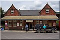


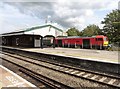
![Westbury railway station [1] in BA13 4FJ](https://images.propbar.co.uk/images/geograph/73/44/7344929_120.jpg)
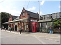
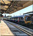
![Westbury railway station [2] in BA13 4FJ](https://images.propbar.co.uk/images/geograph/73/44/7344930_120.jpg)
86 photos from this area
Area Information
Key information about the BA13 4FJ including its size, population, and administrative classification.
- Area Type
- Postcode
- Area Size
- 2.3 hectares
- Population
- 1626
- Population Density
- 1715 people/km²
House Prices in BA13 4FJ
50
Properties
£249,719
Average Sold Price
£72,000
Lowest Price
£331,756
Highest Price
Showing 50 properties
| Address | Type | Beds | Baths | Last Sale Price | Last Sale Date | |
|---|---|---|---|---|---|---|
| 18 Amazon Way, Westbury, BA13 4FJ | Semi-detached | 4 | 2 | £320,000 | Nov 2024 | |
| 60 Amazon Way, Westbury, BA13 4FJ | Flat | - | - | £135,000 | Jul 2024 | |
| 50 Amazon Way, Westbury, BA13 4FJ | Flat | - | - | £72,000 | Apr 2024 | |
| 34 Amazon Way, Westbury, BA13 4FJ | house | - | - | £172,000 | Feb 2024 | |
| 74 Amazon Way, Westbury, BA13 4FJ | Detached | 4 | 2 | £312,000 | Dec 2021 | |
| 72 Amazon Way, Westbury, BA13 4FJ | house | - | - | £308,000 | Dec 2021 | |
| 70 Amazon Way, Westbury, BA13 4FJ | house | - | - | £299,995 | Dec 2021 | |
| 42 Amazon Way, Westbury, BA13 4FJ | house | - | - | £113,997 | Jul 2021 | |
| 46 Amazon Way, Westbury, BA13 4FJ | house | - | - | £325,000 | Jun 2021 | |
| 32 Amazon Way, Westbury, BA13 4FJ | Semi-detached | 4 | 2 | £296,876 | Jun 2021 |
Page 1 of 5
Energy Efficiency in BA13 4FJ
Amenities
Schools
| Rank | School | Type | Entry gender | Ages |
|---|
Explore more schools in this area
Go to Schools tabDemographics
Household Size
Family (3-5 people)
most common
Accommodation Type
Houses
most common
Tenure
47
majority
Ethnic Group
White
most common
Religion
N/A
most common
Household Composition
N/A
most common
Age
47
median
Adults (30-64 years)
most common
Household Deprivation
N/A
with no deprivation
NS-SEC
21
in Lower managerial occupations
Explore more demographic insights in this area
Go to Demographics tabPlanning
Planning Constraints
- Flood RiskPremium
- Ramsar Wetland SitesPremium
- Area of Outstanding Natural BeautyPremium
- Protected Nature ReservePremium
- Protected WoodlandPremium