Area Overview for BA13 4EN
Photos of BA13 4EN
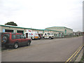
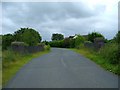
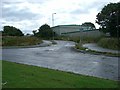
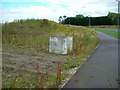


52 photos from this area
Area Information
Key information about the BA13 4EN including its size, population, and administrative classification.
- Area Type
- Postcode
- Area Size
- 87.2 hectares
- Population
- 1278
- Population Density
- 112 people/km²
House Prices in BA13 4EN
8
Properties
£233,750
Average Sold Price
£125,000
Lowest Price
£430,000
Highest Price
Showing 8 properties
| Address | Type | Beds | Baths | Last Sale Price | Last Sale Date | |
|---|---|---|---|---|---|---|
| Orchard House, Brook Lane, Westbury, BA13 4EN | house | - | - | £430,000 | Dec 2019 | |
| 2 Brook Lane, Westbury, BA13 4EN | storage_distribution | - | - | £125,000 | Aug 2017 | |
| 1 Brook Lane, Westbury, BA13 4EN | office_workshop | - | - | £170,000 | Jul 2015 | |
| Brookfield, Brook Lane, Westbury, BA13 4EN | office_workshop | - | - | £210,000 | Jun 2010 | |
| Brook Farm, Brook Lane, Westbury, BA13 4EN | Detached | 5 | 2 | - | - | |
| Waste Matters Ltd, Brook Lane, Westbury, BA13 4EN | Industrial | - | - | - | - | |
| Brook Cottage, Brook Lane, Westbury, BA13 4EN | Detached | 5 | - | - | - | |
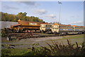
| Northacre Resource Recovery Centre, Stephenson Road, Northacre Industrial Park, Westbury, BA13 4EN | Industrial | - | - | - | - |
Energy Efficiency in BA13 4EN
Amenities
Schools
| Rank | School | Type | Entry gender | Ages |
|---|
Explore more schools in this area
Go to Schools tabDemographics
Household Size
Two person
most common
Accommodation Type
Houses
most common
Tenure
86
majority
Ethnic Group
White
most common
Religion
N/A
most common
Household Composition
N/A
most common
Age
47
median
Adults (30-64 years)
most common
Household Deprivation
N/A
with no deprivation
NS-SEC
41
in Lower managerial occupations
Explore more demographic insights in this area
Go to Demographics tabPlanning
Planning Constraints
- Flood RiskPremium
- Ramsar Wetland SitesPremium
- Area of Outstanding Natural BeautyPremium
- Protected Nature ReservePremium
- Protected WoodlandPremium