Area Overview for BA13 4AU
Photos of BA13 4AU
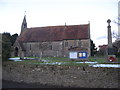
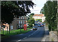
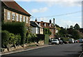
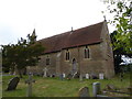
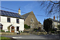
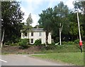
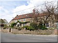
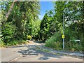
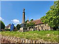
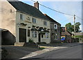
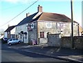
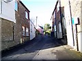
17 photos from this area
Area Information
Key information about the BA13 4AU including its size, population, and administrative classification.
- Area Type
- Postcode
- Area Size
- 10.4 hectares
- Population
- 1393
- Population Density
- 73 people/km²
House Prices in BA13 4AU
18
Properties
£324,045
Average Sold Price
£105,500
Lowest Price
£745,000
Highest Price
Showing 18 properties
| Address | Type | Beds | Baths | Last Sale Price | Last Sale Date | |
|---|---|---|---|---|---|---|
| 18 Southcroft, Chapmanslade, BA13 4AU | Terraced | 2 | 1 | £267,000 | Nov 2023 | |
| South Cottage, 26 Southcroft, Chapmanslade, BA13 4AU | Detached | 4 | 3 | £745,000 | Feb 2021 | |
| 16 Southcroft, Chapmanslade, BA13 4AU | house | 3 | - | £260,000 | Feb 2017 | |
| 20 Southcroft, Chapmanslade, BA13 4AU | house | 3 | - | £290,000 | Feb 2016 | |
| 32 Southcroft, Chapmanslade, BA13 4AU | Detached | 4 | - | £395,000 | Nov 2015 | |
| 38 Southcroft, Chapmanslade, BA13 4AU | Detached | 6 | 3 | £500,000 | Jan 2015 | |
| 34 Southcroft, Chapmanslade, BA13 4AU | Detached | 4 | - | £416,000 | Dec 2013 | |
| 24 Southcroft, Chapmanslade, BA13 4AU | Terraced | - | - | £149,950 | May 2002 | |
| 30 Southcroft, Chapmanslade, BA13 4AU | Detached | 4 | 1 | £105,500 | Mar 1997 | |
| The Hips, 25 Southcroft, Chapmanslade, BA13 4AU | Detached | - | - | £112,000 | Oct 1996 |
Page 1 of 2
Energy Efficiency in BA13 4AU
Amenities
Schools
| Rank | School | Type | Entry gender | Ages |
|---|
Explore more schools in this area
Go to Schools tabDemographics
Household Size
Two person
most common
Accommodation Type
Houses
most common
Tenure
81
majority
Ethnic Group
White
most common
Religion
N/A
most common
Household Composition
N/A
most common
Age
47
median
Adults (30-64 years)
most common
Household Deprivation
N/A
with no deprivation
NS-SEC
43
in Lower managerial occupations
Explore more demographic insights in this area
Go to Demographics tabPlanning
Planning Constraints
- Flood RiskPremium
- Ramsar Wetland SitesPremium
- Area of Outstanding Natural BeautyPremium
- Protected Nature ReservePremium
- Protected WoodlandPremium