Area Overview for BA13 3XY
Photos of BA13 3XY
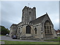
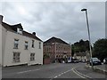
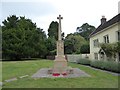
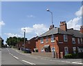
100 photos from this area
Area Information
Key information about the BA13 3XY including its size, population, and administrative classification.
- Area Type
- Postcode
- Area Size
- 1.5 hectares
- Population
- 1888
- Population Density
- 5071 people/km²
House Prices in BA13 3XY
45
Properties
£163,729
Average Sold Price
£50,500
Lowest Price
£324,000
Highest Price
Showing 45 properties
| Address | Type | Beds | Baths | Last Sale Price | Last Sale Date | |
|---|---|---|---|---|---|---|
| 39 Nightingale Drive, Westbury, BA13 3XY | Terraced | 2 | 1 | £192,750 | Oct 2024 | |
| 10 Nightingale Drive, Westbury, BA13 3XY | Semi-detached | 3 | 1 | £280,000 | May 2024 | |
| 19 Nightingale Drive, Westbury, BA13 3XY | Terraced | 3 | 1 | £260,000 | Mar 2024 | |
| 43 Nightingale Drive, Westbury, BA13 3XY | house | 3 | 1 | £236,000 | Dec 2023 | |
| 35 Nightingale Drive, Westbury, BA13 3XY | Terraced | 2 | 1 | £197,500 | Nov 2023 | |
| 14 Nightingale Drive, Westbury, BA13 3XY | Terraced | 2 | 1 | £175,000 | Sep 2023 | |
| 2 Nightingale Drive, Westbury, BA13 3XY | Terraced | 2 | 1 | £211,000 | May 2022 | |
| 12 Nightingale Drive, Westbury, BA13 3XY | Retail | 2 | 1 | £240,000 | Mar 2022 | |
| 26 Nightingale Drive, Westbury, BA13 3XY | house | - | - | £207,500 | Sep 2021 | |
| 25 Nightingale Drive, Westbury, BA13 3XY | house | - | - | £324,000 | Sep 2021 |
Page 1 of 5
Energy Efficiency in BA13 3XY
Amenities
Schools
| Rank | School | Type | Entry gender | Ages |
|---|
Explore more schools in this area
Go to Schools tabDemographics
Household Size
One person
most common
Accommodation Type
Houses
most common
Tenure
59
majority
Ethnic Group
White
most common
Religion
N/A
most common
Household Composition
N/A
most common
Age
47
median
Adults (30-64 years)
most common
Household Deprivation
N/A
with no deprivation
NS-SEC
30
in Lower managerial occupations
Explore more demographic insights in this area
Go to Demographics tabPlanning
Planning Constraints
- Flood RiskPremium
- Ramsar Wetland SitesPremium
- Area of Outstanding Natural BeautyPremium
- Protected Nature ReservePremium
- Protected WoodlandPremium