Area Overview for BA13 3EL
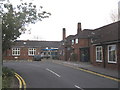
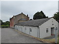
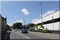
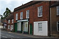
Photos of BA13 3EL
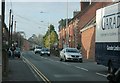

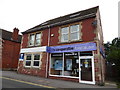
![Westbury buildings [12] in BA13 3EL](https://images.propbar.co.uk/images/geograph/68/24/6824717_120.jpg)
![Westbury houses [29] in BA13 3EL](https://images.propbar.co.uk/images/geograph/68/25/6825966_120.jpg)
![Westbury buildings [14] in BA13 3EL](https://images.propbar.co.uk/images/geograph/68/25/6825973_120.jpg)
Area Information
Living in BA13 3EL means being part of a tightly knit residential cluster in west Wiltshire, a region steeped in historical significance. The area’s population of 1,497 people is densely packed, with 1,465 residents per square kilometre, reflecting its small, compact nature. This postcode lies within the historic market town of Westbury, once a royal manor recorded in the Domesday Book. Daily life here is shaped by its rural setting, with proximity to Salisbury Plain and the Westbury White Horse hill figure. The community is largely composed of adults aged 30–64, many of whom own their homes. BA13 3EL’s character is defined by its mix of traditional architecture, local heritage, and practical amenities. Residents benefit from nearby rail links and a range of retail options, while the area’s low crime rate and minimal environmental risks make it appealing for those seeking a stable, low-maintenance lifestyle. The town’s historical roots, including its medieval burgages and All Saints’ Church, add a layer of cultural richness to everyday living.
- Area Type
- Postcode
- Area Size
- Not available
- Population
- 1497
- Population Density
- 1465 people/km²
The property market in BA13 3EL is dominated by owner-occupied homes, with 87% of residents living in properties they own. This high rate of home ownership suggests a community that values stability and long-term investment. The accommodation type is primarily houses, which is typical of rural and semi-rural areas where larger properties are more common. Given the area’s small size and compact population, the housing stock is likely limited, making it a niche market for buyers seeking a specific location. The prevalence of houses may also indicate a lower density of apartments or flats, which are less common in such settings. For buyers, this means a focus on individual properties rather than shared spaces, with potential for family-oriented living. However, the limited scale of the area may restrict options, requiring buyers to consider nearby suburbs or towns for broader choices. The high home ownership rate also suggests a competitive market, where properties may hold value over time due to their scarcity.
House Prices in BA13 3EL
No properties found in this postcode.
Energy Efficiency in BA13 3EL
The lifestyle in BA13 3EL is shaped by its proximity to essential amenities and a mix of retail and transport options. Within practical reach are five retail outlets, including Aldi Westbury, Morrisons Westbury, and Tesco Westbury, providing residents with access to everyday shopping needs. These stores cater to a range of preferences, from budget-friendly groceries to larger supermarket chains. The area’s rail network, with stations at Westbury, Dilton Marsh, and Warminster, enhances accessibility to nearby towns and cultural hubs. While the data does not specify parks or leisure facilities, the historical and natural features of Westbury, such as the Westbury White Horse, suggest opportunities for outdoor activities. The combination of retail convenience, rail connectivity, and rural surroundings creates a balanced lifestyle, blending practicality with the tranquillity of a small town. This makes BA13 3EL appealing to those who value ease of access without sacrificing a quieter, community-oriented environment.
Amenities
Schools
The nearest school to BA13 3EL is Compass Community School Athelstan Park, a special school with an Ofsted rating of satisfactory. This institution caters to students with specific educational needs, reflecting the area’s focus on inclusive education. While no other schools are listed in the data, the presence of a special school indicates that families with children requiring tailored support may find the area suitable. However, parents seeking mainstream education for their children may need to look beyond BA13 3EL, as the data does not mention primary or secondary schools in the immediate vicinity. The single school listed underscores the importance of considering proximity to a broader range of educational institutions when evaluating the area for long-term residency. The satisfactory Ofsted rating suggests that the school meets baseline standards but may not offer exceptional resources or outcomes compared to other institutions.
| Rank | School | Type | Entry gender | Ages |
|---|
Explore more schools in this area
Go to Schools tabDemographics
The population of BA13 3EL has a median age of 47, with the majority of residents falling into the 30–64 age range. This suggests a mature, established community with a strong presence of middle-aged adults. Home ownership is exceptionally high at 87%, indicating a preference for long-term residency over rental properties. The area is predominantly composed of houses, which aligns with the demographic profile of older, family-oriented households. The predominant ethnic group is White, reflecting the broader trends in rural England. While specific data on deprivation is not provided, the high home ownership rate and low crime score of 87/100 imply a relatively stable socioeconomic environment. This stability likely contributes to a quality of life characterised by safety, familiarity, and a sense of permanence. The absence of significant diversity metrics does not detract from the area’s appeal but highlights its homogenous nature, which may resonate with those seeking a traditional, low-risk living environment.
Household Size
Accommodation Type
Tenure
Ethnic Group
Religion
Household Composition
Age
Household Deprivation
NS-SEC
Explore more demographic insights in this area
Go to Demographics tabPlanning
Planning Constraints
- Flood RiskPremium
- Ramsar Wetland SitesPremium
- Area of Outstanding Natural BeautyPremium
- Protected Nature ReservePremium
- Protected WoodlandPremium