Area Overview for BA12 8PQ
Photos of BA12 8PQ

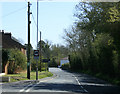

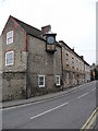
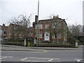
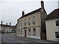

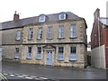
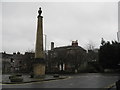

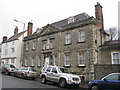
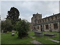
98 photos from this area
Area Information
Key information about the BA12 8PQ including its size, population, and administrative classification.
- Area Type
- Postcode
- Area Size
- 5.5 hectares
- Population
- 1491
- Population Density
- 3501 people/km²
House Prices in BA12 8PQ
25
Properties
£268,613
Average Sold Price
£129,950
Lowest Price
£521,000
Highest Price
Showing 25 properties
| Address | Type | Beds | Baths | Last Sale Price | Last Sale Date | |
|---|---|---|---|---|---|---|
| 40A Church Street, Warminster, BA12 8PQ | Bungalow | 4 | 2 | £521,000 | Dec 2024 | |
| 46 Church Street, Warminster, BA12 8PQ | Terraced | 4 | 2 | £385,000 | Jun 2024 | |
| 42C Church Street, Warminster, BA12 8PQ | Detached | 1 | 1 | £145,000 | Mar 2022 | |
| Winfred Lodge, 44 Church Street, Warminster, BA12 8PQ | Semi-detached | 6 | 2 | £430,000 | Feb 2020 | |
| 29 Church Street, Warminster, BA12 8PQ | Semi-detached | - | - | £160,000 | Apr 2018 | |
| 23 Church Street, Warminster, BA12 8PQ | Terraced | 3 | - | £139,950 | Aug 2013 | |
| 24 Church Street, Warminster, BA12 8PQ | house | - | - | £129,950 | Aug 2007 | |
| Conifer Cottage, 43 Church Street, Warminster, BA12 8PQ | Semi-detached | - | - | £238,000 | May 2006 | |
| Old Coach House, 42 Church Street, Warminster, BA12 8PQ | Terraced | 2 | - | - | - | |
| Teddington House, 47 Church Street, Warminster, BA12 8PQ | Detached | 6 | 3 | - | - |
Page 1 of 3
Energy Efficiency in BA12 8PQ
Amenities
Schools
| Rank | School | Type | Entry gender | Ages |
|---|
Explore more schools in this area
Go to Schools tabDemographics
Household Size
One person
most common
Accommodation Type
Houses
most common
Tenure
60
majority
Ethnic Group
White
most common
Religion
N/A
most common
Household Composition
N/A
most common
Age
47
median
Adults (30-64 years)
most common
Household Deprivation
N/A
with no deprivation
NS-SEC
27
in Lower managerial occupations
Explore more demographic insights in this area
Go to Demographics tabPlanning
Planning Constraints
- Flood RiskPremium
- Ramsar Wetland SitesPremium
- Area of Outstanding Natural BeautyPremium
- Protected Nature ReservePremium
- Protected WoodlandPremium