Area Overview for BA12 8JF
Photos of BA12 8JF
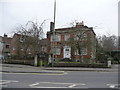
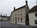
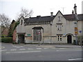
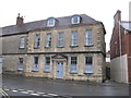
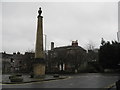
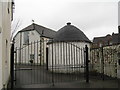
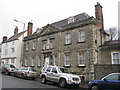
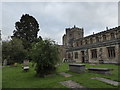
98 photos from this area
Area Information
Key information about the BA12 8JF including its size, population, and administrative classification.
- Area Type
- Postcode
- Area Size
- 6526 m²
- Population
- 1440
- Population Density
- 2886 people/km²
House Prices in BA12 8JF
16
Properties
£186,591
Average Sold Price
£78,000
Lowest Price
£400,000
Highest Price
Showing 16 properties
| Address | Type | Beds | Baths | Last Sale Price | Last Sale Date | |
|---|---|---|---|---|---|---|
| 54 Vicarage Street, Warminster, BA12 8JF | Terraced | 1 | - | £177,000 | Oct 2021 | |
| Dresden Cottage, 46 Vicarage Street, Warminster, BA12 8JF | Detached | - | - | £400,000 | Sep 2021 | |
| 38 Vicarage Street, Warminster, BA12 8JF | house | - | - | £148,500 | Mar 2021 | |
| Holly Cottage, 50 Vicarage Street, Warminster, BA12 8JF | house | - | - | £185,000 | Jul 2018 | |
| 40 Vicarage Street, Warminster, BA12 8JF | Terraced | 2 | 1 | £145,000 | Apr 2018 | |
| 36 Vicarage Street, Warminster, BA12 8JF | house | - | - | £148,500 | Nov 2016 | |
| 56 Vicarage Street, Warminster, BA12 8JF | Terraced | 2 | 1 | £130,000 | Jun 2016 | |
| 42 Vicarage Street, Warminster, BA12 8JF | house | - | - | £145,000 | Mar 2016 | |
| Tudor House, 34 Vicarage Street, Warminster, BA12 8JF | Semi-detached | 4 | - | £367,500 | Dec 2014 | |
| 44 Vicarage Street, Warminster, BA12 8JF | house | - | - | £78,000 | Feb 2002 |
Page 1 of 2
Energy Efficiency in BA12 8JF
Amenities
Schools
| Rank | School | Type | Entry gender | Ages |
|---|
Explore more schools in this area
Go to Schools tabDemographics
Household Size
Two person
most common
Accommodation Type
Houses
most common
Tenure
75
majority
Ethnic Group
White
most common
Religion
N/A
most common
Household Composition
N/A
most common
Age
47
median
Adults (30-64 years)
most common
Household Deprivation
N/A
with no deprivation
NS-SEC
34
in Lower managerial occupations
Explore more demographic insights in this area
Go to Demographics tabPlanning
Planning Constraints
- Flood RiskPremium
- Ramsar Wetland SitesPremium
- Area of Outstanding Natural BeautyPremium
- Protected Nature ReservePremium
- Protected WoodlandPremium