Area Overview for BA12 8HF
Photos of BA12 8HF
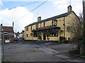
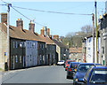
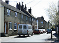
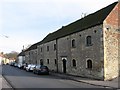
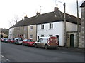
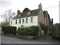
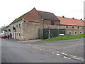
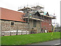
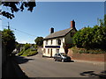
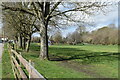
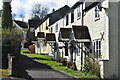
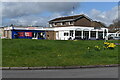
72 photos from this area
Area Information
Key information about the BA12 8HF including its size, population, and administrative classification.
- Area Type
- Postcode
- Area Size
- 9687 m²
- Population
- 1440
- Population Density
- 2886 people/km²
House Prices in BA12 8HF
25
Properties
£183,310
Average Sold Price
£38,000
Lowest Price
£325,000
Highest Price
Showing 25 properties
| Address | Type | Beds | Baths | Last Sale Price | Last Sale Date | |
|---|---|---|---|---|---|---|
| 50 Victoria Road, Warminster, BA12 8HF | Terraced | 2 | 1 | £172,500 | Sep 2025 | |
| 20 Victoria Road, Warminster, BA12 8HF | Semi-detached | 3 | 1 | £325,000 | Jul 2023 | |
| 48 Victoria Road, Warminster, BA12 8HF | house | - | - | £265,000 | May 2022 | |
| 30 Victoria Road, Warminster, BA12 8HF | Semi-detached | 3 | 1 | £290,000 | Mar 2022 | |
| 58 Victoria Road, Warminster, BA12 8HF | house | 3 | - | £245,000 | Dec 2021 | |
| 42 Victoria Road, Warminster, BA12 8HF | house | - | - | £170,000 | Apr 2021 | |
| 34 Victoria Road, Warminster, BA12 8HF | house | - | - | £325,000 | Dec 2020 | |
| 22 Victoria Road, Warminster, BA12 8HF | Terraced | 2 | 1 | £240,000 | Dec 2020 | |
| 28 Victoria Road, Warminster, BA12 8HF | Semi-detached | 3 | - | £204,000 | Jan 2016 | |
| 56 Victoria Road, Warminster, BA12 8HF | house | 2 | 1 | £165,000 | Jan 2016 |
Page 1 of 3
Energy Efficiency in BA12 8HF
Amenities
Schools
| Rank | School | Type | Entry gender | Ages |
|---|
Explore more schools in this area
Go to Schools tabDemographics
Household Size
Two person
most common
Accommodation Type
Houses
most common
Tenure
75
majority
Ethnic Group
White
most common
Religion
N/A
most common
Household Composition
N/A
most common
Age
47
median
Adults (30-64 years)
most common
Household Deprivation
N/A
with no deprivation
NS-SEC
34
in Lower managerial occupations
Explore more demographic insights in this area
Go to Demographics tabPlanning
Planning Constraints
- Flood RiskPremium
- Ramsar Wetland SitesPremium
- Area of Outstanding Natural BeautyPremium
- Protected Nature ReservePremium
- Protected WoodlandPremium