Area Overview for BA12 8ER
Photos of BA12 8ER

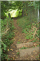
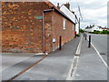
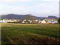
19 photos from this area
Area Information
Key information about the BA12 8ER including its size, population, and administrative classification.
- Area Type
- Postcode
- Area Size
- 7878 m²
- Population
- 2384
- Population Density
- 540 people/km²
House Prices in BA12 8ER
19
Properties
£194,595
Average Sold Price
£57,500
Lowest Price
£310,000
Highest Price
Showing 19 properties
| Address | Type | Beds | Baths | Last Sale Price | Last Sale Date | |
|---|---|---|---|---|---|---|
| 12 St Andrews Road, Warminster, BA12 8ER | Detached | 3 | - | £310,000 | May 2023 | |
| 22 St Andrews Road, Warminster, BA12 8ER | Semi-detached | 3 | 1 | £257,000 | Mar 2021 | |
| 38 St Andrews Road, Warminster, BA12 8ER | house | 3 | - | £244,950 | Oct 2020 | |
| 30 St Andrews Road, Warminster, BA12 8ER | Semi-detached | 3 | - | £240,000 | Aug 2020 | |
| 28 St Andrews Road, Warminster, BA12 8ER | Semi-detached | 3 | 1 | £200,000 | Dec 2017 | |
| 26 St Andrews Road, Warminster, BA12 8ER | Semi-detached | 3 | - | £200,000 | Mar 2017 | |
| 8 St Andrews Road, Warminster, BA12 8ER | house | 3 | - | £165,000 | Jun 2012 | |
| 32 St Andrews Road, Warminster, BA12 8ER | house | - | - | £185,000 | Jul 2009 | |
| 24 St Andrews Road, Warminster, BA12 8ER | Semi-detached | - | - | £86,500 | Dec 2001 | |
| 36 St Andrews Road, Warminster, BA12 8ER | house | - | - | £57,500 | Nov 1996 |
Page 1 of 2
Energy Efficiency in BA12 8ER
Amenities
Schools
| Rank | School | Type | Entry gender | Ages |
|---|
Explore more schools in this area
Go to Schools tabDemographics
Household Size
Two person
most common
Accommodation Type
Houses
most common
Tenure
79
majority
Ethnic Group
White
most common
Religion
N/A
most common
Household Composition
N/A
most common
Age
47
median
Adults (30-64 years)
most common
Household Deprivation
N/A
with no deprivation
NS-SEC
35
in Lower managerial occupations
Explore more demographic insights in this area
Go to Demographics tabPlanning
Planning Constraints
- Flood RiskPremium
- Ramsar Wetland SitesPremium
- Area of Outstanding Natural BeautyPremium
- Protected Nature ReservePremium
- Protected WoodlandPremium