Area Overview for BA12 6AZ
Photos of BA12 6AZ
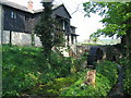
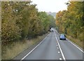
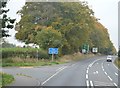
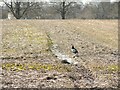
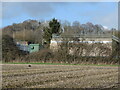
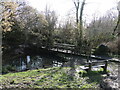
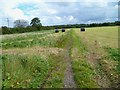
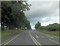

21 photos from this area
Area Information
Key information about the BA12 6AZ including its size, population, and administrative classification.
- Area Type
- Postcode
- Area Size
- 7.7 hectares
- Population
- 1435
- Population Density
- 28 people/km²
House Prices in BA12 6AZ
9
Properties
£373,250
Average Sold Price
£182,500
Lowest Price
£630,000
Highest Price
Showing 9 properties
| Address | Type | Beds | Baths | Last Sale Price | Last Sale Date | |
|---|---|---|---|---|---|---|
| Penorah, Chetcombe Road, Mere, BA12 6AZ | Bungalow | - | - | £470,000 | Jan 2021 | |
| Chetcombe House, Chetcombe Road, Mere, BA12 6AZ | Detached | 6 | - | £630,000 | Jun 2018 | |
| June Cottage, Chetcombe Road, Mere, BA12 6AZ | Detached | 4 | 1 | £315,000 | May 2012 | |
| Windermere, Chetcombe Road, Mere, BA12 6AZ | Bungalow | - | - | £330,000 | Jun 2009 | |
| Nuts, Chetcombe Road, Mere, BA12 6AZ | house | - | - | £312,000 | Jul 2004 | |
| Maple Field, Chetcombe Road, Mere, BA12 6AZ | Detached | - | - | £182,500 | Jul 2002 | |
| Staff Accommodation, Chetcombe House Hotel, Chetcombe Road, Mere, BA12 6AZ | Flat | - | - | - | - | |
| Tennis 41M From Penorah, Chetcombe Road 77M From A303, Chetcombe Road, Mere, BA12 6AZ | Leisure | - | - | - | - | |
| Firenze, Chetcombe Road, Mere, BA12 6AZ | Detached | - | - | - | - |
Energy Efficiency in BA12 6AZ
Amenities
Schools
| Rank | School | Type | Entry gender | Ages |
|---|
Explore more schools in this area
Go to Schools tabDemographics
Household Size
Two person
most common
Accommodation Type
Houses
most common
Tenure
63
majority
Ethnic Group
White
most common
Religion
N/A
most common
Household Composition
N/A
most common
Age
47
median
Adults (30-64 years)
most common
Household Deprivation
N/A
with no deprivation
NS-SEC
37
in Lower managerial occupations
Explore more demographic insights in this area
Go to Demographics tabPlanning
Planning Constraints
- Flood RiskPremium
- Ramsar Wetland SitesPremium
- Area of Outstanding Natural BeautyPremium
- Protected Nature ReservePremium
- Protected WoodlandPremium