Area Overview for BA12 6AB
Photos of BA12 6AB
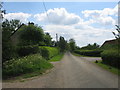
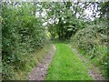
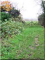
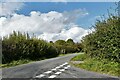
6 photos from this area
Area Information
Key information about the BA12 6AB including its size, population, and administrative classification.
- Area Type
- Postcode
- Area Size
- 1.8 km²
- Population
- 1667
- Population Density
- 74 people/km²
House Prices in BA12 6AB
11
Properties
£389,167
Average Sold Price
£112,500
Lowest Price
£575,000
Highest Price
Showing 11 properties
| Address | Type | Beds | Baths | Last Sale Price | Last Sale Date | |
|---|---|---|---|---|---|---|
| Green Ridge, Barrow Street, Mere, BA12 6AB | Bungalow | 3 | 2 | £480,000 | May 2019 | |
| Longmead, Barrow Street, Mere, BA12 6AB | Detached | 5 | - | £575,000 | Jun 2014 | |
| North Cottage, 1 Barrow Street, Mere, BA12 6AB | Semi-detached | - | - | £112,500 | Nov 1998 | |
| Rose Byre, Barrow Street, Mere, BA12 6AB | Detached | 3 | 1 | - | - | |
| Barrow Street Farm, Barrow Street, Mere, BA12 6AB | house | - | - | - | - | |
| Barrow Street Cottage, Barrow Street, Mere, BA12 6AB | Semi-detached | 3 | 1 | - | - | |
| Barrow Street House, Barrow Street, Mere, BA12 6AB | house | - | - | - | - | |
| The Acorns, Barrow Street, Mere, BA12 6AB | Detached | - | - | - | - | |
| Tennis 58M From Green Ridge, Barrow Street 16M From Pimperleaze Road, Barrow Street, Mere, BA12 6AB | Leisure | - | - | - | - | |
| Breaches Barn, Barrow Street, Mere, BA12 6AB | Detached | 3 | - | - | - |
Page 1 of 2
Energy Efficiency in BA12 6AB
Amenities
Schools
| Rank | School | Type | Entry gender | Ages |
|---|
Explore more schools in this area
Go to Schools tabDemographics
Household Size
Two person
most common
Accommodation Type
Houses
most common
Tenure
84
majority
Ethnic Group
White
most common
Religion
N/A
most common
Household Composition
N/A
most common
Age
47
median
Elderly (65+ years)
most common
Household Deprivation
N/A
with no deprivation
NS-SEC
42
in Lower managerial occupations
Explore more demographic insights in this area
Go to Demographics tabPlanning
Planning Constraints
- Flood RiskPremium
- Ramsar Wetland SitesPremium
- Protected Nature ReservePremium