Area Overview for BA12 0NA
Photos of BA12 0NA
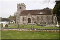
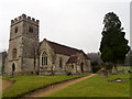
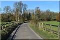
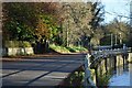
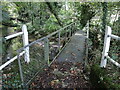
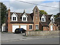
77 photos from this area
Area Information
Key information about the BA12 0NA including its size, population, and administrative classification.
- Area Type
- Postcode
- Area Size
- 1.1 hectares
- Population
- 1307
- Population Density
- 30 people/km²
House Prices in BA12 0NA
15
Properties
£184,682
Average Sold Price
£40,000
Lowest Price
£385,000
Highest Price
Showing 15 properties
| Address | Type | Beds | Baths | Last Sale Price | Last Sale Date | |
|---|---|---|---|---|---|---|
| 2, Bridge Cottages, High Street, Codford, BA12 0NA | house | - | - | £200,000 | Mar 2021 | |
| 1, Bridge Cottages, High Street, Codford, BA12 0NA | house | - | - | £267,500 | Dec 2020 | |
| Ravenhill Cottage, 16 High Street, Codford, BA12 0NA | Detached | 3 | 2 | £385,000 | Oct 2017 | |
| 23 High Street, Codford, BA12 0NA | Terraced | 2 | - | £133,000 | Feb 2016 | |
| Beech Cottage, 16A High Street, Codford, BA12 0NA | Semi-detached | 3 | 2 | £250,000 | Mar 2015 | |
| 24 High Street, Codford, BA12 0NA | Terraced | 2 | - | £102,000 | Jan 2014 | |
| Brook Cottage, 15 High Street, Codford, BA12 0NA | Semi-detached | - | - | £272,500 | Oct 2006 | |
| The Old School, 11 High Street, Codford, BA12 0NA | Detached | 4 | 2 | £282,000 | Aug 2002 | |
| 20 High Street, Codford, BA12 0NA | Terraced | 2 | 1 | £55,000 | May 1999 | |
| 21 High Street, Codford, BA12 0NA | Terraced | - | - | £40,000 | Nov 1997 |
Page 1 of 2
Energy Efficiency in BA12 0NA
Amenities
Schools
| Rank | School | Type | Entry gender | Ages |
|---|
Explore more schools in this area
Go to Schools tabDemographics
Household Size
Two person
most common
Accommodation Type
Houses
most common
Tenure
71
majority
Ethnic Group
White
most common
Religion
N/A
most common
Household Composition
N/A
most common
Age
47
median
Adults (30-64 years)
most common
Household Deprivation
N/A
with no deprivation
NS-SEC
41
in Lower managerial occupations
Explore more demographic insights in this area
Go to Demographics tabPlanning
Planning Constraints
- Flood RiskPremium
- Ramsar Wetland SitesPremium
- Area of Outstanding Natural BeautyPremium
- Protected Nature ReservePremium
- Protected WoodlandPremium