Area Overview for BA11 6TE
Photos of BA11 6TE
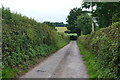
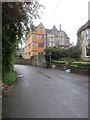
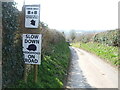
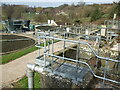
40 photos from this area
Area Information
Key information about the BA11 6TE including its size, population, and administrative classification.
- Area Type
- Postcode
- Area Size
- 55.4 hectares
- Population
- 1315
- Population Density
- 126 people/km²
House Prices in BA11 6TE
10
Properties
£450,000
Average Sold Price
£300,000
Lowest Price
£600,000
Highest Price
Showing 10 properties
| Address | Type | Beds | Baths | Last Sale Price | Last Sale Date | |
|---|---|---|---|---|---|---|
| Dairy House Farm, Stubbs Lane, Beckington, Frome, BA11 6TE | Detached | 8 | 7 | £600,000 | Jan 2018 | |
| Stubby Cottage, Stubbs Lane, Beckington, Frome, BA11 6TE | Chalet | 4 | 3 | £300,000 | Nov 2013 | |
| Horseshoe Lodge, Dairy House Farm, Stubbs Lane, Beckington, Frome, BA11 6TE | Detached | 8 | 6 | - | - | |
| Top Flat, Beckington House, Stubbs Lane, Beckington, Frome, BA11 6TE | Flat | - | - | - | - | |
| Garden Flat, Beckington House, Stubbs Lane, Beckington, Frome, BA11 6TE | Flat | - | - | - | - | |
| Beckington Barn, Stubbs Lane, Beckington, Frome, BA11 6TE | Detached | - | - | - | - | |
| Annexe Horseshoe Lodge, Dairy House Farm, Stubbs Lane, Beckington, Frome, BA11 6TE | Flat | - | - | - | - | |
| George Banco Limited, Office, Dairy House Farm, Stubbs Lane, Beckington, Frome, BA11 6TE | Office | - | - | - | - | |
| The Cottage, Dairy House Farm, Stubbs Lane, Beckington, Frome, BA11 6TE | retail_financial | - | - | - | - | |
| Goodbody Wellness, The Big Blue Building, Stubbs Lane, Beckington, Frome, BA11 6TE | commercial | - | - | - | - |
Energy Efficiency in BA11 6TE
Amenities
Schools
| Rank | School | Type | Entry gender | Ages |
|---|
Explore more schools in this area
Go to Schools tabDemographics
Household Size
Two person
most common
Accommodation Type
Houses
most common
Tenure
75
majority
Ethnic Group
White
most common
Religion
N/A
most common
Household Composition
N/A
most common
Age
47
median
Adults (30-64 years)
most common
Household Deprivation
N/A
with no deprivation
NS-SEC
43
in Lower managerial occupations
Explore more demographic insights in this area
Go to Demographics tabPlanning
Planning Constraints
- Flood RiskPremium
- Ramsar Wetland SitesPremium
- Area of Outstanding Natural BeautyPremium
- Protected Nature ReservePremium
- Protected WoodlandPremium