Area Overview for BA11 3LJ
Photos of BA11 3LJ


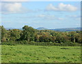
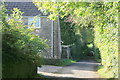
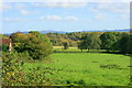
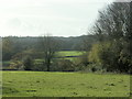
18 photos from this area
Area Information
Key information about the BA11 3LJ including its size, population, and administrative classification.
- Area Type
- Postcode
- Area Size
- 19.1 hectares
- Population
- 2364
- Population Density
- 38 people/km²
House Prices in BA11 3LJ
25
Properties
£566,417
Average Sold Price
£240,000
Lowest Price
£1,150,000
Highest Price
Showing 25 properties
| Address | Type | Beds | Baths | Last Sale Price | Last Sale Date | |
|---|---|---|---|---|---|---|
| The Old Chapel, Old Wells Road, Chantry, Frome, BA11 3LJ | house | 4 | - | £715,000 | Jun 2021 | |
| Edithsgate, Old Wells Road, Chantry, Frome, BA11 3LJ | house | 4 | - | £525,000 | Dec 2020 | |
| The Chimes, Old Wells Road, Chantry, Frome, BA11 3LJ | house | - | - | £625,000 | Dec 2020 | |
| Yew Tree Cottage, Old Wells Road, Chantry, Frome, BA11 3LJ | house | 5 | - | £1,075,000 | Dec 2019 | |
| Mulberry Farmhouse, Old Wells Road, Chantry, Frome, BA11 3LJ | house | - | - | £1,150,000 | Jun 2019 | |
| The Old George, Old Wells Road, Chantry, Frome, BA11 3LJ | Semi-detached | 4 | 2 | £620,000 | May 2019 | |
| Fairfield View, Old Wells Road, Chantry, Frome, BA11 3LJ | house | - | - | £430,000 | Nov 2012 | |
| 1, Belle View Cottages, Old Wells Road, Chantry, Frome, BA11 3LJ | house | 3 | - | £240,000 | Mar 2012 | |
| Eden House, Old Wells Road, Chantry, Frome, BA11 3LJ | Detached | 3 | 1 | £290,000 | Nov 2011 | |
| George Cottage, Old Wells Road, Chantry, Frome, BA11 3LJ | house | - | - | £377,000 | May 2011 |
Page 1 of 3
Energy Efficiency in BA11 3LJ
Amenities
Schools
| Rank | School | Type | Entry gender | Ages |
|---|
Explore more schools in this area
Go to Schools tabDemographics
Household Size
Two person
most common
Accommodation Type
Houses
most common
Tenure
73
majority
Ethnic Group
White
most common
Religion
N/A
most common
Household Composition
N/A
most common
Age
47
median
Adults (30-64 years)
most common
Household Deprivation
N/A
with no deprivation
NS-SEC
39
in Lower managerial occupations
Explore more demographic insights in this area
Go to Demographics tabPlanning
Planning Constraints
- Flood RiskPremium
- Ramsar Wetland SitesPremium
- Area of Outstanding Natural BeautyPremium
- Protected Nature ReservePremium
- Protected WoodlandPremium