Area Overview for BA11 3LA
Photos of BA11 3LA
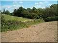
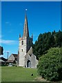
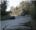
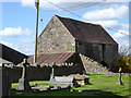
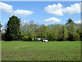
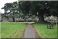
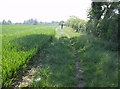
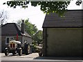
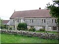
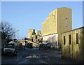


20 photos from this area
Area Information
Key information about the BA11 3LA including its size, population, and administrative classification.
- Area Type
- Postcode
- Area Size
- 84.6 hectares
- Population
- 2364
- Population Density
- 38 people/km²
House Prices in BA11 3LA
25
Properties
£887,750
Average Sold Price
£175,000
Lowest Price
£1,888,000
Highest Price
Showing 25 properties
| Address | Type | Beds | Baths | Last Sale Price | Last Sale Date | |
|---|---|---|---|---|---|---|
| Ponderosa, Old Wells Road, Whatley, Frome, BA11 3LA | Bungalow | 4 | 1 | £510,000 | Mar 2025 | |
| Whatley Farm, Old Wells Road, Whatley, Frome, BA11 3LA | house | 7 | - | £1,795,000 | Apr 2022 | |
| The Old Rectory, Whatley Cottage Lane, Whatley, Frome, BA11 3LA | Detached | - | - | £1,888,000 | Jul 2021 | |
| Prospect Lodge, Whatley Cottage Lane, Whatley, Frome, BA11 3LA | house | - | - | £175,000 | Nov 2018 | |
| Whatley Cottage, Whatley Cottage Lane, Whatley, Frome, BA11 3LA | Bungalow | 4 | - | £665,500 | Aug 2015 | |
| Yew Tree Cottage, Old Wells Road, Whatley, Frome, BA11 3LA | Detached | - | - | £293,000 | Sep 2006 | |
| The Old Post Office, Old Wells Road, Whatley, Frome, BA11 3LA | Detached | 4 | 2 | - | - | |
| The Steading, Old Wells Road, Whatley, Frome, BA11 3LA | Bungalow | 3 | 1 | - | - | |
| Vineyard Cottage, Whatley Cottage Lane, Whatley, Frome, BA11 3LA | Detached | 4 | - | - | - | |
| Whatley Lodge, Old Wells Road, Whatley, Frome, BA11 3LA | Detached | 4 | - | - | - |
Page 1 of 3
Energy Efficiency in BA11 3LA
Amenities
Schools
| Rank | School | Type | Entry gender | Ages |
|---|
Explore more schools in this area
Go to Schools tabDemographics
Household Size
Two person
most common
Accommodation Type
Houses
most common
Tenure
73
majority
Ethnic Group
White
most common
Religion
N/A
most common
Household Composition
N/A
most common
Age
47
median
Adults (30-64 years)
most common
Household Deprivation
N/A
with no deprivation
NS-SEC
39
in Lower managerial occupations
Explore more demographic insights in this area
Go to Demographics tabPlanning
Planning Constraints
- Flood RiskPremium
- Ramsar Wetland SitesPremium
- Area of Outstanding Natural BeautyPremium
- Protected Nature ReservePremium
- Protected WoodlandPremium