Area Overview for BA11 2QS
Photos of BA11 2QS
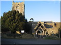
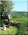
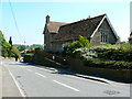
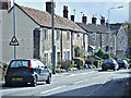
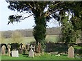
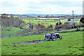
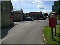
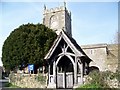
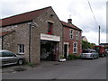
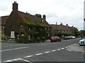
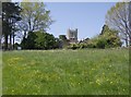
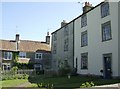
28 photos from this area
Area Information
Key information about the BA11 2QS including its size, population, and administrative classification.
- Area Type
- Postcode
- Area Size
- 19.7 hectares
- Population
- 2215
- Population Density
- 49 people/km²
House Prices in BA11 2QS
17
Properties
£610,429
Average Sold Price
£303,000
Lowest Price
£1,350,000
Highest Price
Showing 17 properties
| Address | Type | Beds | Baths | Last Sale Price | Last Sale Date | |
|---|---|---|---|---|---|---|
| Church Barn, The Cross, Buckland Dinham, Frome, BA11 2QS | Terraced | 3 | 2 | £565,000 | May 2022 | |
| Swallow Barn, The Cross, Buckland Dinham, Frome, BA11 2QS | Bungalow | - | - | £1,350,000 | Jan 2021 | |
| 3 Court Farm, Buckland Dinham, Frome, BA11 2QS | Detached | - | - | £570,000 | Oct 2017 | |
| Cobbles Barn, The Cross, Buckland Dinham, Frome, BA11 2QS | Semi-detached | 3 | 2 | £440,000 | Apr 2014 | |
| 2 Court Farm, Buckland Dinham, Frome, BA11 2QS | Character Property | 3 | 1 | £303,000 | Mar 2010 | |
| The Old Parsonage, The Cross, Buckland Dinham, Frome, BA11 2QS | Detached | - | - | £550,000 | Nov 2000 | |
| Tower House, The Cross, Buckland Dinham, Frome, BA11 2QS | Terraced | - | - | £495,000 | Jun 2000 | |
| Saddleback, The Cross, Buckland Dinham, Frome, BA11 2QS | Detached | 3 | 1 | - | - | |
| Beeches Barn, The Cross, Buckland Dinham, Frome, BA11 2QS | Terraced | - | - | - | - | |
| Manor Farm House, The Cross, Buckland Dinham, Frome, BA11 2QS | Terraced | - | - | - | - |
Page 1 of 2
Energy Efficiency in BA11 2QS
Amenities
Schools
| Rank | School | Type | Entry gender | Ages |
|---|
Explore more schools in this area
Go to Schools tabDemographics
Household Size
Two person
most common
Accommodation Type
Houses
most common
Tenure
78
majority
Ethnic Group
White
most common
Religion
N/A
most common
Household Composition
N/A
most common
Age
47
median
Adults (30-64 years)
most common
Household Deprivation
N/A
with no deprivation
NS-SEC
47
in Lower managerial occupations
Explore more demographic insights in this area
Go to Demographics tabPlanning
Planning Constraints
- Flood RiskPremium
- Ramsar Wetland SitesPremium
- Area of Outstanding Natural BeautyPremium
- Protected Nature ReservePremium
- Protected WoodlandPremium