Area Overview for BA11 1JH
Photos of BA11 1JH


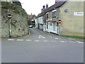
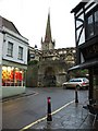


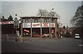
100 photos from this area
Area Information
Key information about the BA11 1JH including its size, population, and administrative classification.
- Area Type
- Postcode
- Area Size
- 785 m²
- Population
- 1869
- Population Density
- 6366 people/km²
House Prices in BA11 1JH
24
Properties
£162,926
Average Sold Price
£99,950
Lowest Price
£242,000
Highest Price
Showing 24 properties
| Address | Type | Beds | Baths | Last Sale Price | Last Sale Date | |
|---|---|---|---|---|---|---|
| 15, The Old Brewery, Gentle Street, Frome, BA11 1JH | Flat | 2 | 1 | £242,000 | Jun 2023 | |
| 20, The Old Brewery, Gentle Street, Frome, BA11 1JH | Flat | - | - | £200,000 | Feb 2022 | |
| 16, The Old Brewery, Gentle Street, Frome, BA11 1JH | Flat | - | - | £242,000 | Dec 2020 | |
| 5, The Old Brewery, Gentle Street, Frome, BA11 1JH | Flat | - | - | £221,500 | Jan 2018 | |
| 18, The Old Brewery, Gentle Street, Frome, BA11 1JH | Flat | 2 | 1 | £200,000 | Mar 2017 | |
| 7, The Old Brewery, Gentle Street, Frome, BA11 1JH | Flat | 2 | - | £180,000 | Apr 2016 | |
| 23, The Old Brewery, Gentle Street, Frome, BA11 1JH | Flat | 2 | - | £135,000 | Aug 2015 | |
| 11, The Old Brewery, Gentle Street, Frome, BA11 1JH | Flat | - | - | £143,000 | Feb 2015 | |
| 12, The Old Brewery, Gentle Street, Frome, BA11 1JH | Flat | - | - | £168,000 | Feb 2015 | |
| 25, The Old Brewery, Gentle Street, Frome, BA11 1JH | Flat | - | - | £182,000 | Jan 2015 |
Page 1 of 3
Energy Efficiency in BA11 1JH
Amenities
Schools
| Rank | School | Type | Entry gender | Ages |
|---|
Explore more schools in this area
Go to Schools tabDemographics
Household Size
One person
most common
Accommodation Type
Houses
most common
Tenure
48
majority
Ethnic Group
White
most common
Religion
N/A
most common
Household Composition
N/A
most common
Age
47
median
Adults (30-64 years)
most common
Household Deprivation
N/A
with no deprivation
NS-SEC
31
in Lower managerial occupations
Explore more demographic insights in this area
Go to Demographics tabPlanning
Planning Constraints
- Flood RiskPremium
- Ramsar Wetland SitesPremium
- Area of Outstanding Natural BeautyPremium
- Protected Nature ReservePremium
- Protected WoodlandPremium