Area Overview for BA11 1EJ
Photos of BA11 1EJ
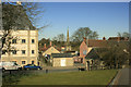
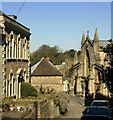
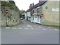
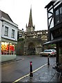
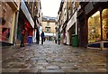

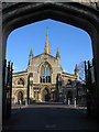
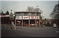
100 photos from this area
Area Information
Key information about the BA11 1EJ including its size, population, and administrative classification.
- Area Type
- Postcode
- Area Size
- 5002 m²
- Population
- 2043
- Population Density
- 5316 people/km²
House Prices in BA11 1EJ
20
Properties
£334,997
Average Sold Price
£130,000
Lowest Price
£760,000
Highest Price
Showing 20 properties
| Address | Type | Beds | Baths | Last Sale Price | Last Sale Date | |
|---|---|---|---|---|---|---|
| 16 South Parade, Frome, BA11 1EJ | Semi-detached | 4 | 2 | £420,000 | Mar 2025 | |
| The Old Meeting House, South Parade, Frome, BA11 1EJ | office_workshop | - | - | £300,000 | Apr 2024 | |
| 22 South Parade, Frome, BA11 1EJ | Terraced | 4 | 2 | £410,000 | Sep 2023 | |
| 18 South Parade, Frome, BA11 1EJ | house | - | - | £360,000 | Sep 2021 | |
| 4 South Parade, Frome, BA11 1EJ | Terraced | 5 | 2 | £760,000 | Nov 2020 | |
| 21 South Parade, Frome, BA11 1EJ | Terraced | 4 | 2 | £340,000 | Dec 2019 | |
| 19 South Parade, Frome, BA11 1EJ | Terraced | 4 | 2 | £350,000 | Feb 2019 | |
| 17 South Parade, Frome, BA11 1EJ | Terraced | 4 | 2 | £345,000 | Dec 2017 | |
| 2 South Parade, Frome, BA11 1EJ | Detached | 2 | 1 | £225,000 | Sep 2016 | |
| 23 South Parade, Frome, BA11 1EJ | house | 4 | - | £220,000 | Feb 2016 |
Page 1 of 2
Energy Efficiency in BA11 1EJ
Amenities
Schools
| Rank | School | Type | Entry gender | Ages |
|---|
Explore more schools in this area
Go to Schools tabDemographics
Household Size
One person
most common
Accommodation Type
Houses
most common
Tenure
48
majority
Ethnic Group
White
most common
Religion
N/A
most common
Household Composition
N/A
most common
Age
47
median
Adults (30-64 years)
most common
Household Deprivation
N/A
with no deprivation
NS-SEC
34
in Lower managerial occupations
Explore more demographic insights in this area
Go to Demographics tabPlanning
Planning Constraints
- Flood RiskPremium
- Ramsar Wetland SitesPremium
- Area of Outstanding Natural BeautyPremium
- Protected Nature ReservePremium
- Protected WoodlandPremium