Area Overview for BA11 1AY
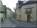
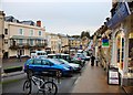
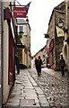
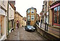
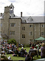
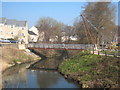
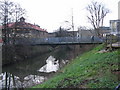
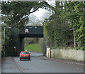
Photos of BA11 1AY
Area Information
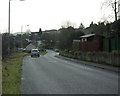
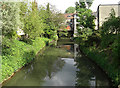
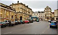
Living in BA11 1AY means being part of a tightly knit residential cluster in eastern Somerset, England. The area covers 1,188 square metres and is home to 1,684 residents, making it one of the most densely populated places in the country at 1,418,087 people per square kilometre. Despite its small size, BA11 1AY sits within the broader Frome town, a historic settlement centred on the River Frome. Frome itself is a town of around 28,000 people, known for its conservation areas, listed buildings, and role as a regional economic hub. BA11 1AY’s proximity to Frome’s town centre, rail links, and retail options makes it a practical choice for those seeking a balance between urban convenience and rural surroundings. The area’s compact nature means amenities are within walking distance, and its high population density reflects a community that values accessibility and local connections. For buyers, this postcode offers a snapshot of Frome’s character: a mix of historic architecture, active markets, and a population skewed toward adults aged 30–64.
- Area Type
- Postcode
- Area Size
- 1188 m²
- Population
- 1684
- Population Density
- 3695 people/km²
The property market in BA11 1AY is dominated by owner-occupied homes, with 55% of properties owned by residents rather than rented. The accommodation type is primarily houses, which suggests a focus on family homes and larger properties. This contrasts with areas where flats or apartments dominate, and it may indicate a preference for private, spacious living. Given the area’s high population density, the housing stock is likely to be compact, with properties designed to maximise space. For buyers, this means a market that prioritises home ownership over rental investment, which could affect property values and availability. The prevalence of houses also implies that the area may be more suited to those seeking a family-friendly environment rather than commuters or students. However, the small size of BA11 1AY means the immediate surroundings are critical for assessing the full range of housing options.
House Prices in BA11 1AY
No properties found in this postcode.
Energy Efficiency in BA11 1AY
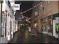
The lifestyle in BA11 1AY is shaped by its proximity to retail and transport hubs. Nearby retail options include Iceland Frome, M&S Frome SF, and The Southern Co-operative Co, offering a range of shopping and grocery needs within practical reach. The area’s rail links—Frome, Dilton Marsh, and Westbury stations—provide direct access to regional centres, enhancing mobility for both leisure and work. While the data does not specify parks or leisure facilities, the broader Frome town is known for its conservation areas and historic sites, suggesting opportunities for outdoor activities and cultural engagement. The compact nature of BA11 1AY means daily life is centred on local amenities, reducing the need for long commutes. This blend of retail convenience, transport options, and nearby natural and cultural attractions contributes to a lifestyle that balances practicality with accessibility.
Amenities
Schools
Residents of BA11 1AY have access to two notable educational institutions nearby. Hayesdown First School is a primary school, providing education for younger children in the area. For older students, Farleigh Further Education College – Frome offers specialist education, though its specific focus is not detailed in the data. The presence of both a primary school and a further education college suggests a comprehensive educational infrastructure for families, covering early years through post-secondary learning. This mix of school types may be particularly beneficial for households with children at different stages of their education, reducing the need to travel to other areas for schooling. However, the absence of secondary schools in the immediate vicinity means families may need to consider proximity to other educational institutions for a full K–12 experience.
| Rank | School | Type | Entry gender | Ages |
|---|
Explore more schools in this area
Go to Schools tabDemographics
The community in BA11 1AY is predominantly composed of adults aged 30–64, with a median age of 47. This suggests a mature, stable population, many of whom may be in their peak working years or raising families. Home ownership rates stand at 55%, indicating a mix of owner-occupied properties and rentals. The accommodation type is primarily houses, which aligns with the area’s residential character and higher property values. The predominant ethnic group is White, reflecting broader demographic trends in the region. The high population density—1,418,087 people per square kilometre—suggests a compact, efficient use of space, though it may also mean limited scope for expansion. This density, combined with the age profile, implies a community focused on established living rather than transient populations. For buyers, this means a market shaped by long-term residents and a demand for homes that cater to family or professional needs.
Household Size
Accommodation Type
Tenure
Ethnic Group
Religion
Household Composition
Age
Household Deprivation
NS-SEC
Explore more demographic insights in this area
Go to Demographics tabPlanning
Planning Constraints
- Flood RiskPremium
- Ramsar Wetland SitesPremium
- Area of Outstanding Natural BeautyPremium
- Protected Nature ReservePremium
- Protected WoodlandPremium