Area Overview for BA10 0PJ
Photos of BA10 0PJ
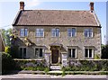
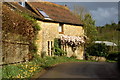
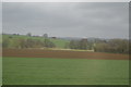
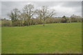
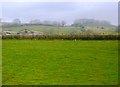
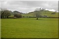
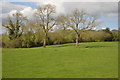
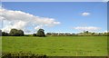


40 photos from this area
Area Information
Key information about the BA10 0PJ including its size, population, and administrative classification.
- Area Type
- Postcode
- Area Size
- 14.7 hectares
- Population
- 2470
- Population Density
- 31 people/km²
House Prices in BA10 0PJ
11
Properties
£297,500
Average Sold Price
£270,000
Lowest Price
£325,000
Highest Price
Showing 11 properties
| Address | Type | Beds | Baths | Last Sale Price | Last Sale Date | |
|---|---|---|---|---|---|---|
| Knapp House, Sunny Hill, Pitcombe, Bruton, BA10 0PJ | Detached | - | - | £325,000 | Mar 2006 | |
| Station House, Sunny Hill, Pitcombe, Bruton, BA10 0PJ | Detached | - | - | £270,000 | Jul 2001 | |
| The Old Station, Sunny Hill, Pitcombe, Bruton, BA10 0PJ | Detached | 3 | 3 | - | - | |
| Cole Manor, Cole To Sunny Hill, Cole, Bruton, BA10 0PJ | Detached | 8 | - | - | - | |
| Lilac Cottage, Cole To Sunny Hill, Cole, Bruton, BA10 0PJ | Semi-detached | - | - | - | - | |
| Tea Room, Cole Manor, Cole To Sunny Hill, Cole, Bruton, BA10 0PJ | Restaurant | - | - | - | - | |
| Cole Style Farm, Cole To Sunny Hill, Cole, Bruton, BA10 0PJ | house | - | - | - | - | |
| Colestile Farm, Colestile Farm Lane, Pitcombe, Bruton, BA10 0PJ | Farm | - | - | - | - | |
| Crandle, Sunny Hill, Pitcombe, Bruton, BA10 0PJ | Detached | - | - | - | - | |
| Hillside, Sunny Hill, Pitcombe, Bruton, BA10 0PJ | house | - | - | - | - |
Page 1 of 2
Energy Efficiency in BA10 0PJ
Amenities
Schools
| Rank | School | Type | Entry gender | Ages |
|---|
Explore more schools in this area
Go to Schools tabDemographics
Household Size
Two person
most common
Accommodation Type
Houses
most common
Tenure
75
majority
Ethnic Group
White
most common
Religion
N/A
most common
Household Composition
N/A
most common
Age
47
median
Adults (30-64 years)
most common
Household Deprivation
N/A
with no deprivation
NS-SEC
38
in Lower managerial occupations
Explore more demographic insights in this area
Go to Demographics tabPlanning
Planning Constraints
- Flood RiskPremium
- Ramsar Wetland SitesPremium
- Area of Outstanding Natural BeautyPremium
- Protected Nature ReservePremium
- Protected WoodlandPremium