Area Overview for BA1 9WA
Photos of BA1 9WA
Area Information
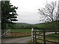
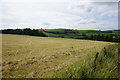
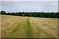
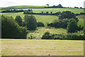
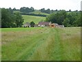
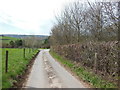
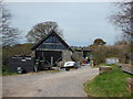
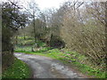
BA1 9WA is a small, rural postcode area nestled in South Gloucestershire, just 5 miles north of Bath. With a population of 1,605 and a low density of 44 people per square kilometre, it retains a quiet, village-like character. The area is part of Cold Ashton, a civil parish with historical roots dating back to the Domesday Book. Its location at the junction of the A46 and A420 roads makes it accessible to nearby towns, including Bath, which lies to the south. Daily life here is shaped by its rural setting, with the Holy Trinity Church—a 14th-century tower rebuilt in the 16th century—standing as a focal point. The area’s small size means a tight-knit community, where familiarity with local landmarks like the Elizabethan Manor House and Old Rectory is common. While it is not a bustling urban hub, BA1 9WA offers a peaceful alternative for those seeking a slower pace of life, with proximity to Bath’s cultural and commercial amenities within a short drive.
- Area Type
- Postcode
- Area Size
- Not available
- Population
- 1605
- Population Density
- 44 people/km²
The property market in BA1 9WA is characterised by high home ownership (80%) and a focus on houses rather than flats or apartments. This suggests a market skewed towards owner-occupied properties, with limited rental activity. The prevalence of houses indicates that the area likely features larger, more traditional homes, which may appeal to families or individuals seeking spacious living. However, the small size of the postcode area means the housing stock is limited, potentially restricting options for buyers. Proximity to Bath via the A46 and A420 roads may make this area attractive to commuters, though the rural setting could deter those seeking urban amenities. For buyers, the challenge lies in the scarcity of properties, which may drive competition and higher prices in the local market.
House Prices in BA1 9WA
No properties found in this postcode.
Energy Efficiency in BA1 9WA
Residents of BA1 9WA have access to a mix of local and regional amenities. Within practical reach are five retail outlets, including Spar and Tesco Bath, offering everyday shopping. The nearby metro stations at Oldland and Bitton provide easy access to public transport, while three rail stations connect to Bath and further afield. The village itself retains a rural charm, with historical sites like the Holy Trinity Church and Elizabethan Manor House adding to its character. For leisure, the proximity to Bath’s cultural attractions—such as museums and theatres—is within a short drive. The combination of local shops, transport links, and historical landmarks creates a lifestyle that balances convenience with a sense of tradition.
Amenities
Schools
| Rank | School | Type | Entry gender | Ages |
|---|
Explore more schools in this area
Go to Schools tabDemographics
The population of BA1 9WA has a median age of 47, with the majority of residents falling in the 30–64 age range. This suggests a mature, stable community with a strong presence of middle-aged adults. Home ownership is high at 80%, indicating that most properties are owner-occupied rather than rented. The accommodation type is predominantly houses, reflecting a preference for larger, private dwellings. The predominant ethnic group is White, which aligns with broader demographic trends in rural England. The age profile and home ownership figures suggest a community that values stability and long-term residence. With no specific data on deprivation or diversity beyond these metrics, the area appears to be relatively homogeneous in terms of socioeconomic and cultural makeup.
Household Size
Accommodation Type
Tenure
Ethnic Group
Religion
Household Composition
Age
Household Deprivation
NS-SEC
Explore more demographic insights in this area
Go to Demographics tabPlanning
Planning Constraints
- Flood RiskPremium
- Ramsar Wetland SitesPremium
- Area of Outstanding Natural BeautyPremium
- Protected Nature ReservePremium
- Protected WoodlandPremium