Area Overview for BA1 9DQ
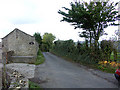
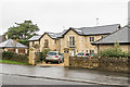
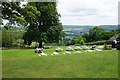
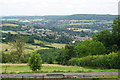
Photos of BA1 9DQ
Area Information
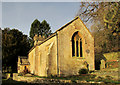
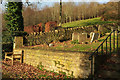
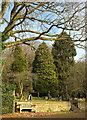
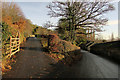
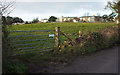
The postcode BA1 9DQ occupies a small residential cluster within the historic Bath & North East Somerset unitary authority. This compact area spans just 767 square metres yet accommodates a population of 2485 people. You are looking at a neighbourhood where density and tradition intersect, situated in the south-west of England. While the specific modern address carries a postcode BA1 9DQ, the broader Lansdown locale described in historical records sits northwards from the city centre. This district forms a significant part of the local fabric, extending up Lansdown Hill alongside Georgian architectural developments. You will find yourself in an environment defined by its heritage, where John Palmer laid out Lansdown Crescent between 1789 and 1793. William Beckford later expanded upon this landscape, building Beckford's Tower atop the hill. Today, daily life here blends proximity to a World Heritage City with the quiet prestige of established residential streets. The area retains a strong connection to its past, featuring landmarks like Lansdown Cemetery, laid out in 1760. You live in a place where the Battle of Lansdowne, fought in 1643, once took place nearby. The cluster remains stable, representing a slice of Somerset where history dictates the rhythm of modern living.
- Area Type
- Postcode
- Area Size
- 767 m²
- Population
- 2485
- Population Density
- 1099 people/km²
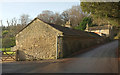
Homes in BA1 9DQ are defined by a predominantly owner-occupied stock, with 81% of residents holding title to their properties. This statistic confirms that the area functions as an established residential zone rather than a hub for short-term rentals or student housing. The primary accommodation type consists of houses, contrasting with the flat-heavy mix found in central Bath. You are evaluating a market where buyers typically seek long-term stability and family-sized properties. The small physical size of the area, covering merely 767 square metres, implies that available inventory will be limited if you wish to purchase. Consequently, you must act quickly if you plan to buy a home in this specific postcode cluster. The high level of home ownership also means that buying involves navigating an area where sellers have often lived there for generations. Property values here likely reflect the prestige of the broader Lansdown location, even within this specific small area. You face a competitive landscape where scarcity of listings meets strong local demand from owner-occupiers.
House Prices in BA1 9DQ
Showing 9 properties
Energy Efficiency in BA1 9DQ
Daily life in BA1 9DQ centres on convenience and access to established retail and transport hubs. You can reach Tesco Bath, Spar Brookside, and Spar within practical reach, ensuring your grocery shopping needs are met quickly without a long journey. The estate also boasts five retail outlets in total, providing a functional local high street experience. For employment commutes, you have access to five railway stations, prominently including Oldfield Park Railway Station and Bath Spa Railway Station. These stations grant you fast trains to London and beyond. You also benefit from bus connections to Bitton and Oldland, expanding your local travel options. The area's character combines these modern conveniences with the historic backdrop of Lansdown Hill. You live steps away from the legacy of Lansdown Cricket Club, founded in 1825, which serves as a local landmark. This mix of retail efficiency and historical gravitas defines your weekly routine.
Amenities
Schools
Families considering BA1 9DQ have access to a diverse selection of educational institutions within practical reach. You can choose from private options such as Kingswood School, Royal High School GDST, and Kingswood Preparatory School, all of which operate as independent schools. These institutions cater to families seeking alternative education pathways outside the state system. For those preferring state education, Abbot Alphege Academy offers an academy curriculum with a satisfactory Ofsted rating. This mixed provision means you can select schools based on philosophy, cost, or educational outcome. The presence of both independent and state academies within proximity to the area allows you to leverage the best options for your children. You do not have to travel far to secure high-quality education for your heirs. The variety of school types supports different family structures and financial situations.
| Rank | School | Type | Entry gender | Ages |
|---|
Explore more schools in this area
Go to Schools tabDemographics
The community within BA1 9DQ reflects a settled, mature demographic profile. The median age stands at 47 years, with adults aged between 30 and 64 representing the most common age range. This indicates a neighbourhood dominated by established families and individuals in their prime working years. Home ownership is exceptionally high, with 81% of residents owning their properties outright or with a mortgage. You are entering a market where few properties change hands for long periods, fostering deep-rooted local knowledge. The predominant ethnic group in this cluster is White, contributing to a relatively homogeneous community structure compared to many parts of Bath. Accommodation types are almost exclusively houses, meaning you will not find flats or maisonettes in this specific postcode. The population density reaches 1099 people per square kilometre, suggesting a fairly tight-knit environment despite the small physical footprint. There is no data available on deprivation indices or purchase price distributions, but the high ownership rate suggests financial stability among residents. You are looking at a stable demographic where longevity and property investment define the social fabric.
Household Size
Accommodation Type
Tenure
Ethnic Group
Religion
Household Composition
Age
Household Deprivation
NS-SEC
Explore more demographic insights in this area
Go to Demographics tabPlanning
Planning Constraints
- Flood RiskPremium
- Ramsar Wetland SitesPremium
- Area of Outstanding Natural BeautyPremium
- Protected Nature ReservePremium
- Protected WoodlandPremium