Area Overview for BA1 9AF
Photos of BA1 9AF
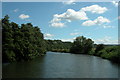
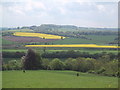
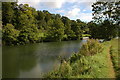
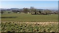
20 photos from this area
Area Information
Key information about the BA1 9AF including its size, population, and administrative classification.
- Area Type
- Postcode
- Area Size
- 72.0 hectares
- Population
- 1293
- Population Density
- 41 people/km²
House Prices in BA1 9AF
16
Properties
£1,254,400
Average Sold Price
£630,000
Lowest Price
£2,300,000
Highest Price
Showing 16 properties
| Address | Type | Beds | Baths | Last Sale Price | Last Sale Date | |
|---|---|---|---|---|---|---|
| Lower Roundhill Barn, Kelston Road, Kelston, Bath, BA1 9AF | Land | - | - | £1,422,000 | Dec 2022 | |
| Tower Cottage, Kelston Road, Kelston, Bath, BA1 9AF | Detached | 6 | 2 | £995,000 | May 2020 | |
| Tower House, Kelston Road, Kelston, Bath, BA1 9AF | house | - | - | £2,300,000 | Aug 2016 | |
| Kelston House, Kelston Road, Kelston, Bath, BA1 9AF | Detached | 5 | 3 | £925,000 | Apr 2014 | |
| Roundhill Farmhouse, Kelston Road, Kelston, Bath, BA1 9AF | Detached | 6 | 3 | £630,000 | Jun 2006 | |
| 1 Kelston Road, Kelston, Bath, BA1 9AF | Detached | 4 | 2 | - | - | |
| The Oak Barn, Kelston Road, Kelston, Bath, BA1 9AF | Detached | - | - | - | - | |
| Hoblins Barn, Roundhill Farmhouse, Kelston Road, Kelston, Bath, BA1 9AF | Semi-detached | - | - | - | - | |
| The Milking Parlour, Roundhill Farmhouse, Kelston Road, Kelston, Bath, BA1 9AF | Semi-detached | - | - | - | - | |
| Beechwood Farm, 2 Kelston Road, Kelston, Bath, BA1 9AF | house | - | - | - | - |
Page 1 of 2
Energy Efficiency in BA1 9AF
Amenities
Schools
| Rank | School | Type | Entry gender | Ages |
|---|
Explore more schools in this area
Go to Schools tabDemographics
Household Size
Two person
most common
Accommodation Type
Houses
most common
Tenure
84
majority
Ethnic Group
White
most common
Religion
N/A
most common
Household Composition
N/A
most common
Age
47
median
Adults (30-64 years)
most common
Household Deprivation
N/A
with no deprivation
NS-SEC
49
in Lower managerial occupations
Explore more demographic insights in this area
Go to Demographics tabPlanning
Planning Constraints
- Flood RiskPremium
- Ramsar Wetland SitesPremium
- Area of Outstanding Natural BeautyPremium
- Protected Nature ReservePremium
- Protected WoodlandPremium