Area Overview for BA1 8AS
Photos of BA1 8AS
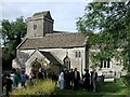
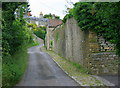
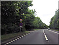
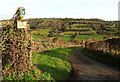
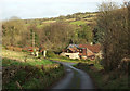
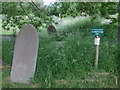
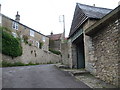
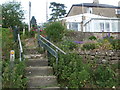
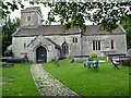
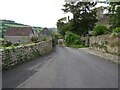
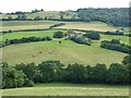

45 photos from this area
Area Information
Key information about the BA1 8AS including its size, population, and administrative classification.
- Area Type
- Postcode
- Area Size
- 8.5 hectares
- Population
- 1293
- Population Density
- 41 people/km²
House Prices in BA1 8AS
12
Properties
£398,000
Average Sold Price
£190,000
Lowest Price
£750,000
Highest Price
Showing 12 properties
| Address | Type | Beds | Baths | Last Sale Price | Last Sale Date | |
|---|---|---|---|---|---|---|
| Gable Cottage, Church Street, Woolley, Bath, BA1 8AS | Terraced | 3 | 1 | £322,000 | Dec 2025 | |
| Bwthyn, 1 Church Street, Woolley, Bath, BA1 8AS | Detached | 3 | 1 | £750,000 | Aug 2023 | |
| Orchard Cottage, Church Street, Woolley, Bath, BA1 8AS | Detached | - | - | £330,000 | Nov 2003 | |
| Freeland Cottage, Church Street, Woolley, Bath, BA1 8AS | Detached | - | - | £190,000 | Apr 1996 | |
| B M A Associates, Summerhaze Farm, Church Street, Woolley, Bath, BA1 8AS | Industrial | - | - | - | - | |
| Global Software Services, Summerhaze Barn, Church Street, Woolley, Bath, BA1 8AS | Office | - | - | - | - | |
| 5 Church Street, Woolley, Bath, BA1 8AS | house | - | - | - | - | |
| 3 Church Street, Woolley, Bath, BA1 8AS | Terraced | - | - | - | - | |
| Manor Farm Annexe, Church Street, Woolley, Bath, BA1 8AS | Detached | - | - | - | - | |
| The Shack, Church Street, Woolley, Bath, BA1 8AS | Detached | - | - | - | - |
Page 1 of 2
Energy Efficiency in BA1 8AS
Amenities
Schools
| Rank | School | Type | Entry gender | Ages |
|---|
Explore more schools in this area
Go to Schools tabDemographics
Household Size
Two person
most common
Accommodation Type
Houses
most common
Tenure
84
majority
Ethnic Group
White
most common
Religion
N/A
most common
Household Composition
N/A
most common
Age
47
median
Adults (30-64 years)
most common
Household Deprivation
N/A
with no deprivation
NS-SEC
49
in Lower managerial occupations
Explore more demographic insights in this area
Go to Demographics tabPlanning
Planning Constraints
- Flood RiskPremium
- Ramsar Wetland SitesPremium
- Area of Outstanding Natural BeautyPremium
- Protected Nature ReservePremium
- Protected WoodlandPremium