Area Overview for BA1 6BP
Photos of BA1 6BP
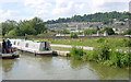

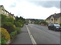
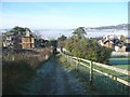
![Folly Footbridge [No 185], from the east in BA1 6BP](https://images.propbar.co.uk/images/geograph/44/82/4482628_120.jpg)
69 photos from this area
Area Information
Key information about the BA1 6BP including its size, population, and administrative classification.
- Area Type
- Postcode
- Area Size
- 3.1 hectares
- Population
- Not available
- Population Density
- Not available
House Prices in BA1 6BP
32
Properties
£208,887
Average Sold Price
£3,000
Lowest Price
£392,000
Highest Price
Showing 32 properties
| Address | Type | Beds | Baths | Last Sale Price | Last Sale Date | |
|---|---|---|---|---|---|---|
| 187 Ringswell Gardens, Lambridge, Bath, BA1 6BP | Terraced | 3 | 1 | £392,000 | Oct 2025 | |
| 151 Ringswell Gardens, Lambridge, Bath, BA1 6BP | Terraced | 3 | 2 | £320,000 | May 2021 | |
| 179 Ringswell Gardens, Lambridge, Bath, BA1 6BP | Terraced | - | - | £335,000 | May 2019 | |
| 177 Ringswell Gardens, Lambridge, Bath, BA1 6BP | Terraced | 3 | 1 | £340,000 | Apr 2019 | |
| 155 Ringswell Gardens, Lambridge, Bath, BA1 6BP | Terraced | - | - | £315,000 | Aug 2017 | |
| 161 Ringswell Gardens, Lambridge, Bath, BA1 6BP | Terraced | - | - | £3,000 | Oct 2016 | |
| 189 Ringswell Gardens, Lambridge, Bath, BA1 6BP | Terraced | 3 | - | £280,000 | May 2016 | |
| 143 Ringswell Gardens, Lambridge, Bath, BA1 6BP | house | 3 | - | £280,000 | Sep 2015 | |
| 137 Ringswell Gardens, Lambridge, Bath, BA1 6BP | Terraced | 3 | - | £250,000 | Feb 2015 | |
| 167 Ringswell Gardens, Lambridge, Bath, BA1 6BP | house | - | - | £204,000 | Feb 2015 |
Page 1 of 4
Energy Efficiency in BA1 6BP
Amenities
Schools
| Rank | School | Type | Entry gender | Ages |
|---|
Explore more schools in this area
Go to Schools tabDemographics
Household Size
Two person
most common
Accommodation Type
Flats
most common
Tenure
56
majority
Ethnic Group
White
most common
Religion
N/A
most common
Household Composition
N/A
most common
Age
47
median
Adults (30-64 years)
most common
Household Deprivation
N/A
with no deprivation
NS-SEC
45
in Lower managerial occupations
Explore more demographic insights in this area
Go to Demographics tabPlanning
Planning Constraints
- Flood RiskPremium
- Ramsar Wetland SitesPremium
- Area of Outstanding Natural BeautyPremium
- Protected Nature ReservePremium
- Protected WoodlandPremium