Area Overview for BA1 4YA
Photos of BA1 4YA
Area Information
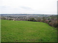
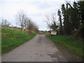
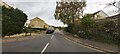
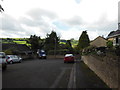
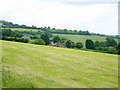
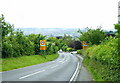
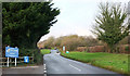
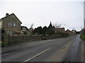
BA1 4YA is a small residential cluster in Weston, a suburb of Bath, England. With a population of 1,478, this area is part of the larger Bath and North East Somerset unitary authority. Historically a separate village, Weston became integrated into Bath during urban expansion in the 19th and 20th centuries. Today, it is a quiet, low-density suburb characterised by older homes and a close-knit community. The area’s population is predominantly adults aged 30–64, with a median age of 47, suggesting a stable, mature demographic. Home ownership is high at 87%, with most properties being houses rather than flats. This reflects a residential area focused on family living, with a strong sense of local identity. Residents benefit from proximity to Bath’s amenities while retaining a village-like atmosphere. The area’s small size means it is not a commercial hub, but its integration into Bath’s transport network ensures easy access to the city’s cultural and economic centres. Living here offers a balance between suburban tranquillity and urban connectivity.
- Area Type
- Postcode
- Area Size
- Not available
- Population
- 1478
- Population Density
- 3168 people/km²
The property market in BA1 4YA is dominated by owner-occupied homes, with 87% of properties owned by residents rather than rented. The accommodation type is primarily houses, reflecting a suburban character rather than high-density development. This suggests a market focused on family homes and long-term investment. The area’s small size means housing stock is limited, but the high home ownership rate indicates strong local demand and stability. Buyers should expect a market where properties are likely to be well-maintained and traditional in style, given the age of the housing stock. The proximity to Bath’s city centre may also influence property values, as the area benefits from its integration into Bath’s transport network. However, the limited number of properties means competition could be fierce for available homes.
House Prices in BA1 4YA
No properties found in this postcode.
Energy Efficiency in BA1 4YA
Residents of BA1 4YA have access to a range of amenities within walking or short driving distance. Five retail outlets include Spar Brookside, Tesco Bath, and other local shops, ensuring everyday shopping needs are met. The area’s proximity to rail and metro stations enhances connectivity to Bath’s cultural and commercial hubs. While the data does not specify parks or leisure facilities, the historical integration of Weston into Bath suggests nearby green spaces and community areas. The presence of multiple transport options and retail venues contributes to a convenient, self-contained lifestyle, balancing local convenience with access to larger urban amenities.
Amenities
Schools
The nearest school to BA1 4YA is Weston All Saints CofE Primary School, a primary school with an Ofsted rating of ‘good’. This school serves the local community and is likely to be a key consideration for families. The absence of secondary schools in the immediate area means students may need to commute to Bath or nearby towns for secondary education. The presence of a well-rated primary school suggests a focus on early education within the community, though parents should plan for secondary schooling elsewhere. The school’s rating indicates a satisfactory standard of teaching and facilities, which is important for families prioritising education quality.
| Rank | School | Type | Entry gender | Ages |
|---|
Explore more schools in this area
Go to Schools tabDemographics
The population of BA1 4YA is 1,478, with a median age of 47. The majority of residents are adults aged 30–64, indicating a community of established professionals and families. Home ownership is exceptionally high at 87%, with most properties being houses rather than flats. This suggests a long-term, settled population rather than a transient rental market. The predominant ethnic group is White, reflecting the area’s historical and cultural ties to Bath’s broader demographic profile. The absence of specific data on deprivation means no conclusions can be drawn about economic hardship, but the high home ownership rate and age profile imply a relatively stable and affluent community. The area’s maturity—both in age and housing stock—means it is less likely to experience rapid demographic shifts, offering continuity for residents.
Household Size
Accommodation Type
Tenure
Ethnic Group
Religion
Household Composition
Age
Household Deprivation
NS-SEC
Explore more demographic insights in this area
Go to Demographics tabPlanning
Planning Constraints
- Flood RiskPremium
- Ramsar Wetland SitesPremium
- Area of Outstanding Natural BeautyPremium
- Protected Nature ReservePremium
- Protected WoodlandPremium