Area Overview for BA1 4XN
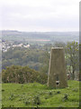
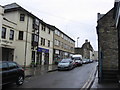
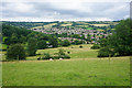
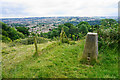
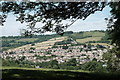
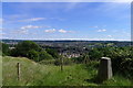
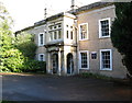
Photos of BA1 4XN

Area Information
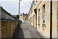
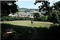
Living in BA1 4XN means being part of a small, tightly knit residential cluster in the northwest of Bath, Somerset. With a population of 1,478, this area has grown through historical urban expansion, blending Victorian-era housing with post-war developments. Its proximity to Bath’s city centre offers easy access to cultural and commercial hubs, while retaining a village-like character. The area’s demographics reflect a mature community, with a median age of 47 and most residents aged 30–64. Over 87% own their homes, predominantly in houses rather than flats, creating a stable, long-term residential base. Families are well-served by Weston All Saints CofE Primary School, which has a ‘good’ Ofsted rating, and nearby amenities like Spar Brookside and Tesco Bath provide daily convenience. The area’s low crime risk and absence of environmental constraints make it appealing for those seeking a safe, low-maintenance lifestyle. Its integration into Bath’s unitary authority ensures access to broader services, while its compact size fosters a sense of familiarity and community.
- Area Type
- Postcode
- Area Size
- Not available
- Population
- 1478
- Population Density
- 3168 people/km²
The property market in BA1 4XN is defined by high home ownership (87%) and a predominance of houses over flats. This suggests a residential stock tailored to families and long-term occupants, with limited rental availability. The area’s small size means property choices are constrained, but the focus on houses implies larger, more private living spaces compared to high-density developments. Buyers should consider that the market is likely competitive, with limited new builds given the area’s integration into Bath’s urban fabric. Proximity to Bath’s amenities may enhance property value, but the lack of planning constraints or protected sites means development is not restricted. For those seeking a stable, low-risk investment, BA1 4XN’s established housing stock offers predictable demand, though its compact nature means buyers must act quickly to secure properties.
House Prices in BA1 4XN
No properties found in this postcode.
Energy Efficiency in BA1 4XN
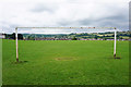
Daily life in BA1 4XN is shaped by its mix of retail, transport, and community amenities. The area’s five retail outlets include Spar Brookside, Tesco Bath, and other local shops, offering convenience for groceries and essentials. Proximity to rail stations like Oldfield Park and Bath Spa, along with metro stops at Bitton and Oldland, ensures easy access to Bath’s cultural and commercial centres. While the area lacks large parks or leisure facilities, its integration into Bath’s urban network means residents can enjoy the city’s attractions, including museums, theatres, and green spaces like the Royal Victoria Park. The presence of a single primary school and limited local amenities underscores the area’s role as a residential suburb rather than a standalone hub, but its connectivity to Bath’s broader offerings enriches the lifestyle for residents.
Amenities
Schools
The primary school nearest to BA1 4XN is Weston All Saints CofE Primary School, which has a ‘good’ Ofsted rating. This institution serves the area’s children from reception through to Year 6, providing a foundation for local education. The absence of secondary schools in the immediate vicinity means families may need to consider commuting to Bath’s secondary schools, such as King Edward’s School or The Blue School. The single primary school reflects the area’s small size but ensures a focused, community-oriented educational environment. Parents should note that the school’s ‘good’ rating indicates satisfactory standards, though additional research into secondary options is advisable for long-term planning.
| Rank | School | Type | Entry gender | Ages |
|---|
Explore more schools in this area
Go to Schools tabDemographics
BA1 4XN’s population of 1,478 is dominated by adults aged 30–64, with a median age of 47. This suggests a community of established professionals and families, rather than students or retirees. The high home ownership rate of 87% indicates long-term residency and stability, with most properties being houses rather than flats. The predominant ethnic group is White, reflecting the area’s historical ties to Bath’s broader demographic profile. The absence of specific deprivation data means no direct insights into economic challenges, but the high home ownership and mature age profile suggest a relatively affluent, low-turnover population. This demographic mix supports a quiet, family-oriented environment where local amenities and schools are central to daily life. The lack of younger residents or transient populations further reinforces the area’s settled character.
Household Size
Accommodation Type
Tenure
Ethnic Group
Religion
Household Composition
Age
Household Deprivation
NS-SEC
Explore more demographic insights in this area
Go to Demographics tabPlanning
Planning Constraints
- Flood RiskPremium
- Ramsar Wetland SitesPremium
- Area of Outstanding Natural BeautyPremium
- Protected Nature ReservePremium
- Protected WoodlandPremium