Area Overview for BA1 4JY
Photos of BA1 4JY
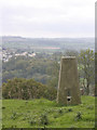
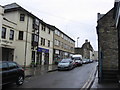
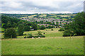


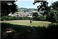
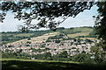
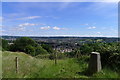


52 photos from this area
Area Information
Key information about the BA1 4JY including its size, population, and administrative classification.
- Area Type
- Postcode
- Area Size
- 8475 m²
- Population
- 1478
- Population Density
- 3168 people/km²
House Prices in BA1 4JY
19
Properties
£318,786
Average Sold Price
£69,000
Lowest Price
£531,000
Highest Price
Showing 19 properties
| Address | Type | Beds | Baths | Last Sale Price | Last Sale Date | |
|---|---|---|---|---|---|---|
| 28 Broadmoor Lane, Upper Weston, Bath, BA1 4JY | Detached | 3 | 1 | £428,000 | Oct 2025 | |
| 32 Broadmoor Lane, Upper Weston, Bath, BA1 4JY | house | 4 | 2 | £525,000 | Jun 2023 | |
| 34 Broadmoor Lane, Upper Weston, Bath, BA1 4JY | Semi-detached | 5 | 1 | £531,000 | Sep 2022 | |
| 8 Broadmoor Lane, Upper Weston, Bath, BA1 4JY | house | - | - | £412,000 | Mar 2021 | |
| 24 Broadmoor Lane, Upper Weston, Bath, BA1 4JY | house | - | - | £465,000 | Sep 2020 | |
| 4 Broadmoor Lane, Upper Weston, Bath, BA1 4JY | Semi-detached | - | - | £319,500 | Jun 2019 | |
| 12 Broadmoor Lane, Upper Weston, Bath, BA1 4JY | Semi-detached | 3 | 1 | £371,500 | Sep 2017 | |
| 38 Broadmoor Lane, Upper Weston, Bath, BA1 4JY | Detached | 3 | - | £290,000 | May 2012 | |
| 16 Broadmoor Lane, Upper Weston, Bath, BA1 4JY | house | - | - | £287,000 | Aug 2010 | |
| 6 Broadmoor Lane, Upper Weston, Bath, BA1 4JY | house | - | - | £249,999 | Oct 2009 |
Page 1 of 2
Energy Efficiency in BA1 4JY
Amenities
Schools
| Rank | School | Type | Entry gender | Ages |
|---|
Explore more schools in this area
Go to Schools tabDemographics
Household Size
Family (3-5 people)
most common
Accommodation Type
Houses
most common
Tenure
87
majority
Ethnic Group
White
most common
Religion
N/A
most common
Household Composition
N/A
most common
Age
47
median
Adults (30-64 years)
most common
Household Deprivation
N/A
with no deprivation
NS-SEC
50
in Lower managerial occupations
Explore more demographic insights in this area
Go to Demographics tabPlanning
Planning Constraints
- Flood RiskPremium
- Ramsar Wetland SitesPremium
- Area of Outstanding Natural BeautyPremium
- Protected Nature ReservePremium
- Protected WoodlandPremium