Area Overview for BA1 4AQ
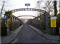
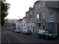
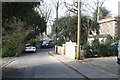
Photos of BA1 4AQ

Area Information
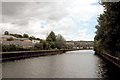
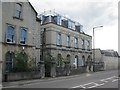
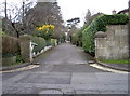
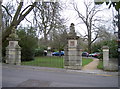
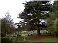
Living in BA1 4AQ offers a distinct experience within the wider Weston area of Bath and North East Somerset. This specific postcode covers a small residential cluster measuring 5,124 square metres, containing a population of 2,136 people. The density here is significant, with records showing 416,862 people per kilometre squared, reflecting a compact community layout. Originally part of the historic village of Weston which became integrated into Bath during Victorian times, the area retains a residential character shaped by its long history. Weston was recorded in the Domesday Book with two manors and 41 households, evolving through periods of drainage works and Georgian development to become a civil parish in 1866. Today, southern parts of the original parish were absorbed into Bath while rural sections joined Charlcombe and Kelston. The geography places you in the northwest of the city near coordinates 51.404964, -2.393862. You are stepping into an established zone that balances historic roots with modern suburban convenience. The small scale of the postcode means you live in a specific, defined residential cluster rather than a sprawling district. This concentration supports local interactions while maintaining proximity to wider Bath amenities. You gain access to a neighbourhood where history meets everyday living, situated close to landmarks like Weston Lower Mill on Weston Island and featuring memorials at All Saints Church.
- Area Type
- Postcode
- Area Size
- 5124 m²
- Population
- 2136
- Population Density
- 3950 people/km²
The property market in BA1 4AQ is defined by a stock of houses suitable for owners rather than investors. With 70 per cent of residents owning their homes, the area functions as a traditional owner-occupied neighbourhood. The overwhelming majority of available homes suit families, as houses dominate the accommodation type data. This concentration of private ownership means you will find fewer buy-to-let properties compared to mixed-use postcode districts. The specific nature of this small residential cluster results in a housing market where transactions often reflect moves between established households rather than transient rentals. Properties here are likely suited to those seeking stability, given the high ownership percentage and mature demographic average of 47 years. The accommodation mix prioritises domestic space over宿舍-style living or high-density flats. When looking at homes in this area, you are evaluating stock designed for long-term residence. The lower preponderance of rental housing suggests a market where capital growth and quality of living often drive investment decisions rather than short-term yield. Buyers looking at this small area will find a predictable environment focused on permanent homes.
House Prices in BA1 4AQ
Showing 2 properties
| Address | Type | Beds | Baths | Last Sale Price | Last Sale Date | |
|---|---|---|---|---|---|---|
| King Edward School, Weston Lane, Lower Weston, Bath, BA1 4AQ | commercial | - | - | - | - | |
| The Lodge, King Edward School, Weston Lane, Lower Weston, Bath, BA1 4AQ | Detached | - | - | - | - |
Energy Efficiency in BA1 4AQ
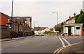
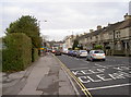
Residents of BA1 4AQ enjoy convenient access to retail and transport hubs within practical reach of their homes. For shopping needs, five retail locations serve the area, including Tesco Windsor, Spar, and Tesco Bath. These supermarkets are situated nearby to ensure you do not need to travel far for groceries or daily necessities. Transport links are equally accessible, with five rail stations operating close by. Oldfield Park Railway Station, Bath Spa Railway Station, and Freshford Railway Station form the core of your rail network, providing connections to broader Bath and beyond. You also have access to two Metro points at Bitton and Oldland, offering alternative public transport options if needed. This connectivity means you can easily commute to the city centre or travel to Somerset without relying solely on your car. The dense network of nearby amenities supports a lifestyle where convenience is always within walking or short driving distance. You do not have to venture far to find essential services or catch a train service.
Amenities
Schools
Education options for families living in BA1 4AQ are anchored by The Park School. This independent school provides educational facilities for children residing in the immediate vicinity. The presence of an independent option offers an alternative to state-maintained schools, though you should verify specific admissions criteria as independent institutions often have their own requirements. While there is one independent school listed, the data does not specify Ofsted ratings or state school names available within the immediate radius of this postcode. Families considering schools near BA1 4AQ must look beyond the single named independent institution to understand the full educational landscape. The reliance on The Park School indicates a local choice for private education for those who can access it. If you are in the 30 to 64 age range and have young children, the proximity to this independent facility is a primary amenity. Further research into nearby primary or secondary state schools would be necessary to complete a full picture for buyers with school-age children, as the provided data highlights only this one specific name.
| Rank | School | Type | Entry gender | Ages |
|---|
Explore more schools in this area
Go to Schools tabDemographics
The community in BA1 4AQ reflects a mature, settled population with strong home ownership. The median age stands at 47, placing most residents firmly within the adult bracket of 30 to 64 years. Nearly three-quarters of these residents own their homes, as the home ownership rate reaches 70 per cent. This level of stability suggests a neighbourhood where families and long-term residents have put down roots. The predominant ethnic group is White, forming the largest demographic segment within this cluster. Houses form the principal type of accommodation, indicating that the built environment caters primarily to family living and established households rather than high-density blocks. You can expect a demographic profile where the majority of the population falls into the working-age category with significant representation from older adults. The high rate of homeownership contrasts with areas dominated by the private rental sector, providing security for those purchasing properties in this postcode. The age profile means you are joining a community deeply embedded in the local area, where neighbours likely know each other through years of shared residency. This demographic steadiness contributes to a quiet atmosphere, distinct from rapidly changing urban centres.
Household Size
Accommodation Type
Tenure
Ethnic Group
Religion
Household Composition
Age
Household Deprivation
NS-SEC
Explore more demographic insights in this area
Go to Demographics tabPlanning
Planning Constraints
- Flood RiskPremium
- Ramsar Wetland SitesPremium
- Area of Outstanding Natural BeautyPremium
- Protected Nature ReservePremium
- Protected WoodlandPremium