Area Overview for BA1 3PB
Photos of BA1 3PB
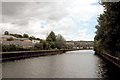
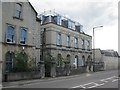
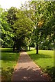
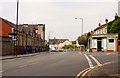
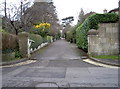
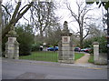
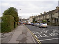
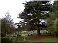

100 photos from this area
Area Information
Key information about the BA1 3PB including its size, population, and administrative classification.
- Area Type
- Postcode
- Area Size
- 2.0 hectares
- Population
- 1316
- Population Density
- 2940 people/km²
House Prices in BA1 3PB
31
Properties
£436,963
Average Sold Price
£115,000
Lowest Price
£900,000
Highest Price
Showing 31 properties
| Address | Type | Beds | Baths | Last Sale Price | Last Sale Date | |
|---|---|---|---|---|---|---|
| 60 Cedric Road, Lower Weston, Bath, BA1 3PB | Semi-detached | 5 | 2 | £900,000 | Sep 2023 | |
| 64 Cedric Road, Lower Weston, Bath, BA1 3PB | house | - | - | £510,000 | Jun 2019 | |
| 98 Cedric Road, Lower Weston, Bath, BA1 3PB | house | - | - | £495,000 | Dec 2018 | |
| 72 Cedric Road, Lower Weston, Bath, BA1 3PB | house | - | - | £680,000 | Feb 2018 | |
| 56 Cedric Road, Lower Weston, Bath, BA1 3PB | house | - | - | £518,000 | Dec 2016 | |
| 46 Cedric Road, Lower Weston, Bath, BA1 3PB | house | - | - | £548,000 | Oct 2016 | |
| 78 Cedric Road, Lower Weston, Bath, BA1 3PB | house | - | - | £457,500 | Dec 2015 | |
| 82 Cedric Road, Lower Weston, Bath, BA1 3PB | Semi-detached | 3 | 1 | £391,000 | Jan 2015 | |
| 50 Cedric Road, Lower Weston, Bath, BA1 3PB | Semi-detached | 3 | 1 | £399,300 | Jan 2015 | |
| 58 Cedric Road, Lower Weston, Bath, BA1 3PB | Semi-detached | 5 | - | £480,000 | Aug 2014 |
Page 1 of 4
Energy Efficiency in BA1 3PB
Amenities
Schools
| Rank | School | Type | Entry gender | Ages |
|---|
Explore more schools in this area
Go to Schools tabDemographics
Household Size
Family (3-5 people)
most common
Accommodation Type
Houses
most common
Tenure
67
majority
Ethnic Group
White
most common
Religion
N/A
most common
Household Composition
N/A
most common
Age
47
median
Adults (30-64 years)
most common
Household Deprivation
N/A
with no deprivation
NS-SEC
50
in Lower managerial occupations
Explore more demographic insights in this area
Go to Demographics tabPlanning
Planning Constraints
- Flood RiskPremium
- Ramsar Wetland SitesPremium
- Area of Outstanding Natural BeautyPremium
- Protected Nature ReservePremium
- Protected WoodlandPremium