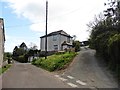
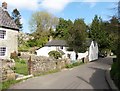
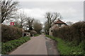
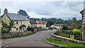
Area Overview for All Saints
Photos of All Saints

Area Information
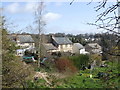
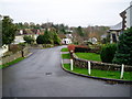
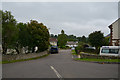
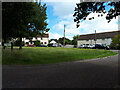
Living in All Saints means residing within a distinct electoral ward located in Cheltenham Borough Council, Gloucestershire. This specific area covers a geographical footprint of 5.7 square kilometres and serves a population of 5,362 residents. You will find yourself in a setting that balances residential life with the administrative structure of a unitary ward. The defined boundaries create a compact community where daily routines rely heavily on local infrastructure. Prospective buyers should note that the ward ID 4550 governs this portion of the town. While specific coordinates exist in some datasets, the practical reality of life here is centred around the established layout of Cheltenham. You are purchasing into a space with a clear legal and geographical definition. The area caters to a specific demographic, as evidenced by the age profiles and housing tenure data available for the ward. Understanding the size and location of All Saints is the first step in evaluating its suitability for your home search. This section provides the foundational context needed to interpret the deeper statistics about crime, demographics, and transport links that follow.
- Area Type
- District Borough Unitary Ward
- Area Size
- 5.7 km²
- Population
- Not available
- Population Density
- Not available
Demographics
The community living in All Saints reflects a mature demographic profile. The median age for residents stands at 70 years, indicating a population skewed significantly towards older age groups. You are likely to live among neighbours who have established long-term roots in the area. Half of the male and 49% of the female residents fit into the total household composition categories provided for this ward. Home ownership rates are notably high, with 85% of households owning their property outright or with a mortgage. This statistic suggests a stable, owner-occupied market rather than a transient rental environment. The low percentage of renters typically means fewer short-term leases and more stability in the neighbourhood. You will find that accommodation types are generally suited for those with established needs rather than a mix of student housing or temporary lodgings. Diversity metrics and religious affiliations are recorded at the total level, though the primary ethnic group remains a key identifier for the ward's character. Living here means joining a cohort where life stages are advancement rather than early career moves. The age range data confirms that this is a retirement-friendly or established family zone.
Household Size
Accommodation Type
Tenure
Ethnic Group
Religion
Household Composition
Age
Household Deprivation
NS-SEC
Explore more demographic insights in this area
Go to Demographics tabPlanning
Planning Constraints
- Flood RiskPremium
- Ramsar Wetland SitesPremium
- Area of Outstanding Natural BeautyPremium
- Protected Nature ReservePremium
- Protected WoodlandPremium
- Crime RiskPremium