Area Overview for Wye with Hinxhill
Photos of Wye with Hinxhill

Area Information
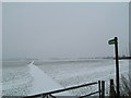
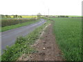
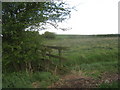
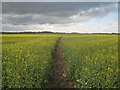
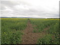
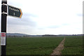
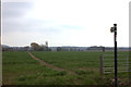
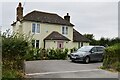
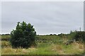
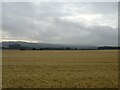
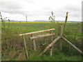
Wye with Hinxhill sits within the Kent countryside as a civil parish covering 23.8 square kilometres. This rural setting defines the daily rhythm of life for residents seeking a quiet retreat away from urban noise. The landscape is tightly constrained by significant planning protections, which shape both the visual character and development potential of the valley. You will find yourself living in an environment where designated Areas of Outstanding Natural Beauty frame the horizon, ensuring that large-scale construction remains rare. These geographical features create a distinct sense of place, but they also impose strict rules on what you can build on your land. The area contains protected woodland and nature reserves, meaning the greenery you enjoy comes with conservation obligations that developers must respect. While the parking lot for new subdivisions stays closed, the existing homes offer a stable, established neighbourhood. If you are considering homes in Wye with Hinxhill, you are entering a market defined by scarcity and preservation rather than rapid expansion. The community feels intimate because the land itself limits how many neighbours you can acquire. Your view might overlook ancient hills or flowing water, reinforcing a connection to the natural world that city dwellers struggle to replicate. This environment suits those who value privacy and scenic vistas over proximity to major shopping centres or transport hubs. The 23.8 kilometre square stretch of land ensures that every mile walked or cycled becomes a deliberate part of your routine.
- Area Type
- District Borough Unitary Ward
- Area Size
- 23.8 km²
- Population
- Not available
- Population Density
- Not available
Demographics
The social fabric of Wye with Hinxhill is defined by an exceptionally older population, with a median age of 70 years. Most residents fall into the total age bracket, suggesting a community composed largely of retirees or older couples. Almost two-thirds of households, specifically 64 per cent, are owner-occupied, indicating deep roots and long-term stability for the families who call this parish home. You will rarely encounter a high turnover of tenants or new occupants moving in every few months. The accommodation stock reflects this permanent settlement pattern, as owners tend to upgrade their properties or age in place rather than rent out to transient populations. The demographic profile suggests a village that has transitioned into a retirement haven, where the pace of life slows after the workweek ends. Safety figures support this quieter environment, with a crime risk score of 74 out of 100, which places the area well below the national average for incidents. This low risk level allows residents to enjoy open spaces without constant vigilance. The diversity of the population appears limited, with specific data on predominant ethnic groups, religions, and household composition types not detailed in the available records. However, the high ownership rate implies that most people know each other across decades. Community activities likely revolve around local clubs or churches that have served the same generations for a long time. For anyone looking at the community, this translates to a friendly but potentially insular atmosphere where newcomers may need time to integrate.
Household Size
Accommodation Type
Tenure
Ethnic Group
Religion
Household Composition
Age
Household Deprivation
NS-SEC
Explore more demographic insights in this area
Go to Demographics tabPlanning
Planning Constraints
- Flood RiskPremium
- Ramsar Wetland SitesPremium
- Area of Outstanding Natural BeautyPremium
- Protected Nature ReservePremium
- Protected WoodlandPremium
- Crime RiskPremium