Area Overview for West Thorney
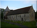
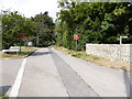
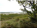
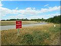
Photos of West Thorney


Area Information
West Thorney is a small built-up area in England, covering 2.7 km². It is a place where older residents predominate, with a median age of 70, suggesting a community shaped by long-term settlement. The area’s compact size means amenities and services are within practical reach, though it is not densely populated. Daily life here is likely characterised by a quiet, low-key rhythm, with access to nearby rail and ferry networks offering connectivity to larger towns. The presence of Thorney Island Community Primary School, rated good by Ofsted, indicates a focus on education for local families. While the area’s demographics suggest a mature population, its proximity to Emsworth and Southbourne railway stations could appeal to commuters or those seeking a balance between rural tranquillity and urban accessibility. For buyers, West Thorney offers a distinct niche: a small, older community with limited but functional infrastructure, where property ownership is less common than renting. This makes it a unique choice for those prioritising affordability or seeking a specific lifestyle over high-density living.
- Area Type
- Built Up Area 250
- Area Size
- 2.7 km²
- Population
- Not available
- Population Density
- Not available
West Thorney’s lifestyle is shaped by its proximity to practical amenities, including five retail outlets such as Tesco Emsworth and The Southern Co-operative Co. These shops provide access to essentials, though the variety may be limited compared to larger towns. The rail network offers frequent connections to nearby stations, facilitating travel for work or leisure. Ferry services to Hayling Island and Itchenor add a maritime dimension, potentially appealing to those seeking scenic routes or island getaways. The area’s compact size means these amenities are within walking or short driving distance, though the lack of detailed data on parks or leisure facilities leaves their availability unclear. For residents, the combination of retail, transport, and water-based connectivity creates a functional, if modest, lifestyle foundation.
Amenities
Schools
Thorney Island Community Primary School is the only school listed in the data for West Thorney. It is a primary school with a good Ofsted rating, which is a key consideration for families. The absence of secondary schools or other educational institutions in the immediate vicinity means parents may need to look beyond the area for comprehensive schooling. However, the presence of a well-rated primary school could be a draw for families prioritising early education. The single school listed suggests a limited educational ecosystem, which may impact long-term family planning for those requiring access to a full range of school types. For buyers, this means the area may be more suitable for those with alternative schooling arrangements or proximity to other districts with better educational facilities.
| Rank | A + A* % | School | Type | Entry gender | Ages |
|---|---|---|---|---|---|
| 1 | N/A | Thorney Island Community Primary School | primary | N/A | N/A |
Explore more schools in this area
Go to Schools tabDemographics
The population of West Thorney has a median age of 70, with the most common age range encompassing the total population. This suggests a community where older residents form a significant proportion, potentially influencing local services and social dynamics. Home ownership here is at 49%, below the national average, indicating a rental market that may cater to temporary or lower-income residents. The data does not specify household composition or accommodation types, but the overall figures imply a mix of housing stock. The lack of detailed information on ethnic diversity or deprivation means the area’s social fabric remains opaque. However, the low crime risk score of 91 suggests a relatively safe environment, which may be a draw for retirees or those seeking stability. For prospective buyers, the demographic profile highlights a market where property values may be influenced by the area’s aging population and limited demand for larger families.
Household Size
Accommodation Type
Tenure
Ethnic Group
Religion
Household Composition
Age
Household Deprivation
NS-SEC
Explore more demographic insights in this area
Go to Demographics tabPlanning
Planning Constraints
- Crime RiskLocked