Area Overview for West Chiltington
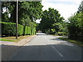
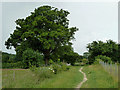
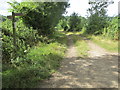
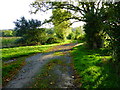
Photos of West Chiltington


Area Information
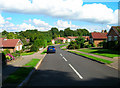
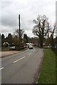
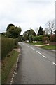
West Chiltington is a built-up area located in West Sussex, England, covering a small footprint of just 2.9 km². This compact size defines the local environment, creating a distinct sense of scale compared to larger towns. Living in West Chiltington means navigating a space where distances are short and the community is tightly knit. You are not looking at a sprawling cityscape but rather a concentrated residential zone. The area functions as a local hub where daily life revolves around immediate neighbours rather than distant districts. While the physical dimensions are modest, the character of the place offers a defined neighbourhood identity. Residents here experience a sense of place that is immediate and tangible. The layout supports a lifestyle where amenities and residences are in close proximity, reducing the need for frequent long-distance travel within the immediate vicinity. This concentration creates an environment where the boundaries of your daily world are clearly established. You will find yourself moving through a space that demands your attention to local details. The absence of endless sprawl means that the sights and sounds of the area are constant and present. This intimacy shapes the rhythm of life in West Chiltington, offering a consistent backdrop for your daily routine.
- Area Type
- Built Up Area 250
- Area Size
- 2.9 km²
- Population
- Not available
- Population Density
- Not available
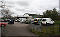
Living in West Chiltington offers immediate access to key retail and transport amenities within practical reach. You can visit five notable retail locations, including Tesco Storrington, Waitrose Storrington, and Morrisons Daily. These supermarkets form the backbone of your local shopping needs, allowing you to grab groceries without travelling far. For rail travel, three stations are nearby: Pulborough Railway Station, Billingshurst Railway Station, and Amberley Railway Station. Although these are not within West Chiltington itself, their proximity supports your travel requirements. This network allows you to access wider regional services and connect with larger towns. The concentration of these facilities means you can manage daily errands and occasional trips efficiently. Retail and transport form the core of the convenient lifestyle available to you. You do not need to encompass the entire area to find your supplies or your transport links. The presence of these specific venues ensures that essential services are never distant. This accessibility defines the practical convenience of living in this built-up area.
Amenities
Schools
Families in the area have West Chiltington Community Primary School as their main local educational option. This institution is a primary school and holds a Good rating from Ofsted. A Good rating signifies that the school meets the required standards of excellence set by the regulator. This specific verdict provides a clear indicator of the educational quality available to children living in West Chiltington. The data lists only this single school, which suggests that attendees of secondary schools will travel outside the immediate local area. You must consider the commute to secondary education when planning your life in West Chiltington, as no secondary institution is listed nearby. The primary school serves the young population within this built-up area, catering to the youngest residents. Its Good status offers reassurance regarding the foundational education your children will receive while they are young. While the local scope is limited to this one primary provider, the quality assurance from Ofsted remains a strong asset for parents. The decision to live here relies heavily on access to this specific educational rating for the early years of schooling.
| Rank | A + A* % | School | Type | Entry gender | Ages |
|---|---|---|---|---|---|
| 1 | N/A | West Chiltington Community Primary School | primary | N/A | N/A |
Explore more schools in this area
Go to Schools tabDemographics
The community in West Chiltington reflects a mature population, with a median age of 70 years. This figure indicates that the neighbourhood attracts residents in their senior years. The most common age grouping simply totals the entire population, confirming that the age distribution is skewed heavily towards older adults. This demographic trend shapes the social fabric of the area. Home ownership stands at 84%, which establishes a clear pattern of residential stability within West Chiltington. The majority of households have purchased their properties and intend to stay. This high rate suggests a community built on long-term commitments rather than the transient nature often found in student villages or major rental hubs. The data points to a neighbourhood where people invest in the foundations of their local life. Accommodation types and ethnic composition are recorded as total figures, indicating a comprehensive snapshot of the resident base without specific breakdowns for categories not listed. Religion and household composition also fall under total records, meaning the dataset aggregates these aspects rather than separating specific beliefs or family structures. For those considering moving here, understanding this age profile is crucial for matching your lifestyle needs with the local environment. The area is defined by this stable, older demographic.
Household Size
Accommodation Type
Tenure
Ethnic Group
Religion
Household Composition
Age
Household Deprivation
NS-SEC
Explore more demographic insights in this area
Go to Demographics tabPlanning
Planning Constraints
- Crime RiskLocked