Area Overview for Wendover, Halton and Stoke Mandeville Ward
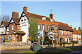
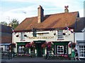
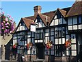
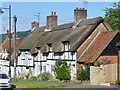
Photos of Wendover, Halton and Stoke Mandeville Ward
Area Information
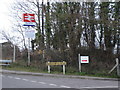
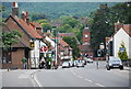
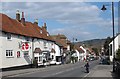
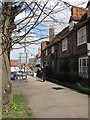
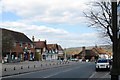
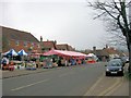
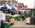
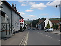
Living in Wendover, Halton and Stoke Mandeville Ward offers a defined sense of place within Buckinghamshire, covering an area of 29.7 square kilometres. This electoral ward encompasses the villages of Wendover, Halton, and Stoke Mandeville in the Vale of Aylesbury, South East England. The core of this community lies near coordinates 51.76241953184917, -0.7445398129599292, where the daily rhythm is dictated by proximity to historic landmarks and modern infrastructure. Stoke Mandeville is located three miles from Aylesbury and just 3.4 miles from Wendover, creating a compact network of residential life. You are entering a region with deep historical roots, recorded as *Stoches* in the Domesday Book of 1086. The area is most notably defined by Stoke Mandeville Hospital, which originated as a 1830 cholera hospital and became the birthplace of the Paralympic movement via Sir Ludwig Guttmann's 1948 Games. The ward sits around the village of Stoke Mandeville, which hosts a significant home for spinal injuries and co-hosted the 1984 Paralympics wheelchair events. Modern residents benefit from the London to Aylesbury Line, with stations at Stoke Mandeville and Wendover providing southbound connections to London Marylebone and northbound links to Aylesbury Vale Parkway. HS2 passes southwest without stopping, while major roads connect directly to Aylesbury. Bus services include Arriva Shires & Essex route 50 on Station Road, plus routes 130, X9, and X90 in the village centre. For those researching homes in this specific ward, you find yourself in a setting where both football heritage and Roman history coexist. Archaeological excavations between 2018 and 2022 ahead of HS2 revealed Roman statues, burial urns, and a possible mausoleum site, recently featured on BBC's *Digging for Britain*. The current St Mary parish church dates to 1866, and a Millennium village sign from 2000 depicts local history clearly.
- Area Type
- District Borough Unitary Ward
- Area Size
- 29.7 km²
- Population
- 3093
- Population Density
- 104 people/km²
Demographics
The community in Wendover, Halton and Stoke Mandeville Ward presents a clear picture concerning who resides and works in the villages. The median age for inhabitants is 70, indicating this is an area dominated by older residents. When you examine the age profile, the data confirms that the total population distribution leans heavily towards the adult and elderly brackets, with the *Age: Total* category identified as the most common age range. This demographic reality shapes the character of schools near Wendover, Halton and Stoke Mandeville Ward, which are likely to cater to families visiting from outside the ward or to meet specific local educational needs. Home ownership rates stand at 67%, suggesting that a thriving majority of the population owns their property rather than renting. This high level of tenure contributes to community stability within the villages of Stoke Mandeville, Wendover, and Halton. You can expect few tenant turnover issues in the local housing stock. While specific breakdowns for household composition, predominant ethnic groups, and religious affiliation are not quantified in the available records, the total household composition data remains the primary metric for understanding family structures. Accommodation types in the ward reflect a settled population with a median age of 70. This implies a stock that may include period properties, former institutions converted to housing, or bungalows suited to older demographics. The density of the area is low, standing at 104 people per square kilometre. For you considering homes in Wendover, Halton and Stoke Mandeville Ward, this low density means every square kilometre of the 29.7 km² merger holds relatively few residents. Consequently, the noise levels are likely lower than in denser urban centres, and you will find less congestion in the village centres.
Household Size
Accommodation Type
Tenure
Ethnic Group
Religion
Household Composition
Age
Household Deprivation
NS-SEC
Explore more demographic insights in this area
Go to Demographics tabPlanning
Planning Constraints
- Flood RiskPremium
- Ramsar Wetland SitesPremium
- Area of Outstanding Natural BeautyPremium
- Protected Nature ReservePremium
- Protected WoodlandPremium