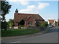
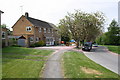
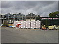
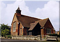
Area Overview for Wantage
Photos of Wantage


Area Information
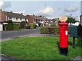
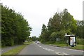
Living in Wantage offers a distinctly settled experience within a defined built-up area covering 3.5 square kilometres. The town maintains a modest footprint while supporting a population of 2,375 residents, resulting in a density of 672 people per square kilometre. This ratio suggests a quiet residential environment where neighbours are close enough to know one another without the congestion found in larger cities. The community feels intimate yet established, avoiding the isolation of rural hamlets while retaining the calm of a smaller settlement. You will find that daily life moves at a measured pace here, particularly compared to faster-growing urban centres. The town serves as a self-contained hub where residents can manage most daily needs in a compact space. The physical scale of Wantage means that amenities are generally within walking distance or a short drive away. This balance between accessibility and tranquility defines the character of homes in Wantage. Prospective buyers looking for a location with a strong sense of place will find the town's size conducive to a manageable lifestyle. The area does not sprawl, ensuring that the core identity of the town remains intact as it continues to function as a traditional market town in Oxfordshire.
- Area Type
- Built Up Area 250
- Area Size
- 3.5 km²
- Population
- 2375
- Population Density
- 672 people/km²
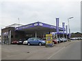
Daily life in Wantage benefits from immediate access to essential retail outlets within practical reach. Residents have three major supermarkets nearby: Sainsburys Wantage, Waitrose Wantage, and Spar Wantage. These venues cover a wide spectrum of grocery needs, from fresh produce to premium imports. The presence of both a discount grocer and a premium retailer ensures competitive pricing options for households. Beyond food shopping, the area supports five total retail outlets according to local records. These smaller shops likely specialise in household goods or local services, adding convenience to the residential fabric. The data does not list specific leisure centres, parks, or dining establishments, but the retail density suggests a walkable high street environment. Living in Wantage means having your essentials at a neighbourly distance. You do not need a car for basic errands if you utilise these local stores. The concentration of reputable brands like Waitrose and Sainsburys indicates a town Centre that cares about consumer goods quality. This retail foundation supports a convenient lifestyle without the need for extensive travel.
Amenities
Schools
Families moving to Wantage have access to a range of educational institutions located within practical reach of the town. The area hosts Wantage Nursery School, which serves the earliest years of childhood development. Primary education options include Wantage County Primary School, Charlton Primary School, Stockham Primary School, and Wantage Church of England Voluntary Controlled Junior School. Among these, Stockham Primary School holds an outstanding Ofsted rating, marking it as a top-tier setting for primary education. The mix of schools includes voluntary controlled institutions and independent-operated primaries, offering various educational philosophies. While the data lists five specific schools, it does not provide capacity figures or catchment zone details for each. The presence of an outstanding-rated school is a significant positive for families prioritising academic performance. There is no data regarding secondary schools listed in the provided records, suggesting the primary catchment may extend to surrounding towns for older children. Parents should research the immediate catchment areas for the listed primaries to confirm placement eligibility. The variety of primary options indicates a robust local education infrastructure.
| Rank | School | Type | Entry gender | Ages |
|---|
Explore more schools in this area
Go to Schools tabDemographics
The community profile in Wantage reflects a mature demographic structure with a median age of 70 years. This high average indicates that the town is a preferred retirement destination or a long-term home for older residents. Age data does not provide a specific breakdown for younger demographics, but the central tendency points to a senior-led population. With 69% of households in Wantage being owned outright or with a mortgage, home ownership is the dominant tenure type. This high ownership rate contrasts sharply with typical renter-heavy cities and suggests residents have a long-term stake in their local environment. The household composition data does not detail family sizes, but the age profile implies a shift away from child-rearing households. Accommodation types are not explicitly broken down in the available records, yet the ownership statistics suggest a stock comprised largely of detached or semi-detached properties favored by retirees. There is limited data regarding ethnic diversity or religious affiliation within the town's records. Without specific figures on cultural makeup, the demographic picture relies heavily on the age and ownership statistics. This concentration of older homeowners likely influences local services and community engagement patterns. The area functions as a stable community where property value retention may correlate with the stability of the owner-occupier base.