Area Overview for Wallingford
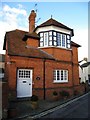
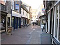
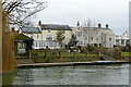
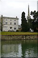
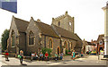
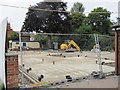
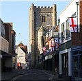
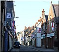
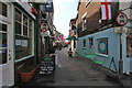
Photos of Wallingford


Area Information
Wallingford is a compact built-up area in England, covering 2.3 km² and home to 2,265 residents. With a population density of 970 people per square kilometre, it’s a tightly knit community where daily life is shaped by proximity to local amenities and transport links. The area’s character is defined by its older demographic, with a median age of 70, suggesting a population skewed towards retirees and long-term residents. Despite its small size, Wallingford offers a mix of practical living with access to nearby rail networks, retail hubs, and educational institutions. Its strategic location near Chalgrove Airport and RAF Benson, combined with rail stations like Didcot Parkway, ensures connectivity to larger cities. For those seeking a quiet, established neighbourhood with a balance of convenience and tranquillity, Wallingford provides a distinct alternative to more sprawling urban areas.
- Area Type
- Built Up Area 250
- Area Size
- 2.3 km²
- Population
- 2265
- Population Density
- 970 people/km²
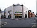
Wallingford’s residents have access to a variety of amenities within practical reach. Retail options include Asda Rectory, Lidl Lupton Road, and Waitrose Wallingford, offering everyday shopping convenience. The area’s rail links to Cholsey and Didcot Parkway, along with nearby airports, support both local and regional travel. While specific parks or leisure facilities are not detailed in the data, the presence of multiple retail and transport hubs suggests a lifestyle focused on practicality and connectivity. The compact nature of the area means amenities are closely clustered, reducing the need for long commutes. For those prioritising ease of access to shopping, transport, and nearby airports, Wallingford provides a functional, well-served environment.
Amenities
Schools
Wallingford’s educational landscape includes several primary schools, such as St John’s Primary School, Fir Tree Junior School, and St Nicholas’ Church of England Infants’ School and Nursery Class. Wallingford School serves as both a primary and academy, holding a ‘good’ Ofsted rating. This mix of school types offers families a range of options, from traditional state schools to academies with potentially distinct curricula. The presence of multiple primary schools suggests a focus on early education, which may be beneficial for families with young children. However, the data does not include secondary schools or further education institutions, so parents seeking comprehensive schooling may need to look beyond the immediate area. The ‘good’ rating at Wallingford School indicates a reliable standard of education, but further research would be needed to assess broader educational opportunities.
| Rank | A + A* % | School | Type | Entry gender | Ages |
|---|---|---|---|---|---|
| 1 | N/A | St John's Primary School | primary | N/A | N/A |
| 2 | N/A | Fir Tree Junior School | primary | N/A | N/A |
| 3 | N/A | St Nicholas' Church of England Infants' School and Nursery Class, Wallingford | primary | N/A | N/A |
| 4 | N/A | Wallingford School | primary | N/A | N/A |
| 5 | N/A | Wallingford School | academy | N/A | N/A |
Explore more schools in this area
Go to Schools tabDemographics
Wallingford’s population is predominantly older, with a median age of 70, reflecting a community where retirees and long-term residents form the majority. Home ownership is high at 71%, indicating a stable housing market with many properties held by private owners rather than landlords. The data does not specify household composition or accommodation types, but the overall figures suggest a mature demographic profile. This age structure may influence local services and social dynamics, with a focus on healthcare and community engagement. While no specific deprivation data is provided, the high home ownership rate and moderate population density imply a relatively self-sufficient community. However, the lack of detailed breakdowns on diversity or household types means broader social trends remain unexplored.
Household Size
Accommodation Type
Tenure
Ethnic Group
Religion
Household Composition
Age
Household Deprivation
NS-SEC
Explore more demographic insights in this area
Go to Demographics tabPlanning
Planning Constraints
- Crime RiskLocked