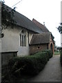
Area Overview for Upper Farringdon
Photos of Upper Farringdon


Area Information
Upper Farringdon is a compact built-up area in England, spanning 38.5 hectares. Its population, though not explicitly stated, is likely small given its size, and the median age of 70 suggests a community skewed toward older residents. This area is distinct for its quiet, established character, with a strong emphasis on home ownership—81% of residents own their homes. Daily life here is shaped by proximity to practical amenities, including retail stores, railway stations, and a nearby airport. The area’s small footprint means residents are likely within walking or short driving distance of essential services. While it lacks the density of larger urban centres, Upper Farringdon offers a simpler, more self-contained lifestyle. Its location near towns like Alton and Liss provides access to broader networks without the congestion of city living. For those seeking a peaceful, stable environment with a focus on local connectivity, Upper Farringdon presents a unique blend of practicality and quietude.
- Area Type
- Built Up Area 250
- Area Size
- 38.5 hectares
- Population
- Not available
- Population Density
- Not available
Living in Upper Farringdon offers access to a range of practical amenities within easy reach. The area’s retail options include M&S Alton SF, Sainsburys Alton, and Iceland Alton, providing everyday shopping needs. Nearby metro stops at Medstead & Four Marks and Ropley connect residents to broader transport networks, while Alton Railway Station and Liss Railway Station offer direct links to larger towns. The proximity to Lasham Airport adds convenience for those requiring regional air travel. Though the area is small, its amenities are functional and well-situated for daily life. The combination of retail, transport, and travel options ensures that residents can manage errands, commuting, and leisure activities without long journeys. This balance of practicality and accessibility is a key feature of Upper Farringdon’s lifestyle.
Amenities
Schools
| Rank | School | Type | Entry gender | Ages |
|---|
Explore more schools in this area
Go to Schools tabDemographics
The population of Upper Farringdon has a median age of 70, reflecting a community predominantly composed of older residents. This age profile is notable, as it indicates a demographic that may have long-standing ties to the area. Home ownership is high, with 81% of residents living in properties they own, suggesting a stable, long-term population. The data does not specify household types or ethnic diversity, but the figures provided confirm that the area is not highly deprived, which likely supports a quality of life focused on comfort and security. The lack of detailed breakdowns on accommodation types or household composition means broader generalisations are limited. However, the high home ownership rate implies a community where residents are likely to have established roots. This demographic profile may appeal to those seeking a low-maintenance lifestyle with minimal turnover.
Household Size
Accommodation Type
Tenure
Ethnic Group
Religion
Household Composition
Age
Household Deprivation
NS-SEC
Explore more demographic insights in this area
Go to Demographics tabPlanning
Planning Constraints
- Crime RiskPremium