Area Overview for UB9 4EQ
Photos of UB9 4EQ
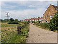
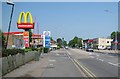
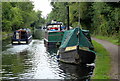
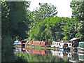
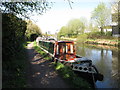
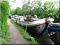
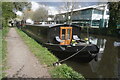
33 photos from this area
Area Information
Key information about the UB9 4EQ including its size, population, and administrative classification.
- Area Type
- Postcode
- Area Size
- 1.4 hectares
- Population
- 1917
- Population Density
- 491 people/km²
House Prices in UB9 4EQ
19
Properties
£402,909
Average Sold Price
£235,000
Lowest Price
£612,500
Highest Price
Showing 19 properties
| Address | Type | Beds | Baths | Last Sale Price | Last Sale Date | |
|---|---|---|---|---|---|---|
| 49 Knighton Way Lane, New Denham, UB9 4EQ | house | 3 | 2 | £569,000 | Jul 2025 | |
| 43 Knighton Way Lane, New Denham, UB9 4EQ | Semi-detached | 3 | - | £490,000 | Feb 2017 | |
| 45 Knighton Way Lane, New Denham, UB9 4EQ | Semi-detached | 4 | 2 | £612,500 | Jul 2016 | |
| 39 Knighton Way Lane, New Denham, UB9 4EQ | Semi-detached | 3 | 3 | £435,000 | Jun 2014 | |
| 53 Knighton Way Lane, New Denham, UB9 4EQ | Semi-detached | 4 | 2 | £372,000 | Feb 2014 | |
| 47 Knighton Way Lane, New Denham, UB9 4EQ | house | 5 | - | £515,000 | Mar 2012 | |
| 51 Knighton Way Lane, New Denham, UB9 4EQ | house | 3 | - | £352,000 | Apr 2011 | |
| 41 Knighton Way Lane, New Denham, UB9 4EQ | Semi-detached | 3 | - | £303,000 | Dec 2010 | |
| 67 Knighton Way Lane, New Denham, UB9 4EQ | Semi-detached | 4 | - | £235,000 | Apr 2005 | |
| 55 Knighton Way Lane, New Denham, UB9 4EQ | Semi-detached | - | - | £273,500 | Feb 2004 |
Page 1 of 2
Energy Efficiency in UB9 4EQ
Amenities
Schools
| Rank | School | Type | Entry gender | Ages |
|---|
Explore more schools in this area
Go to Schools tabDemographics
Household Size
Family (3-5 people)
most common
Accommodation Type
Houses
most common
Tenure
64
majority
Ethnic Group
White
most common
Religion
N/A
most common
Household Composition
N/A
most common
Age
47
median
Adults (30-64 years)
most common
Household Deprivation
N/A
with no deprivation
NS-SEC
39
in Lower managerial occupations
Explore more demographic insights in this area
Go to Demographics tabPlanning
Planning Constraints
- Flood RiskPremium
- Ramsar Wetland SitesPremium
- Area of Outstanding Natural BeautyPremium
- Protected Nature ReservePremium
- Protected WoodlandPremium