Area Overview for TW20 9QY
Photos of TW20 9QY
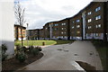
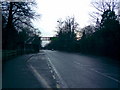
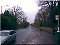
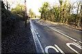
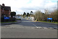
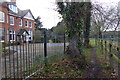
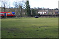
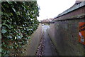

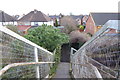
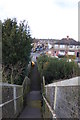
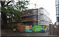
50 photos from this area
Area Information
Key information about the TW20 9QY including its size, population, and administrative classification.
- Area Type
- Postcode
- Area Size
- 1.3 hectares
- Population
- 1545
- Population Density
- 2603 people/km²
House Prices in TW20 9QY
42
Properties
£349,991
Average Sold Price
£95,000
Lowest Price
£650,000
Highest Price
Showing 42 properties
| Address | Type | Beds | Baths | Last Sale Price | Last Sale Date | |
|---|---|---|---|---|---|---|
| 66 Clarence Street, Egham, TW20 9QY | Semi-detached | 3 | 1 | £550,000 | Jul 2025 | |
| 49 Clarence Street, Egham, TW20 9QY | Semi-detached | 3 | 2 | £650,000 | May 2024 | |
| 70 Clarence Street, Egham, TW20 9QY | Semi-detached | 3 | 2 | £565,000 | Sep 2023 | |
| 57 Clarence Street, Egham, TW20 9QY | Terraced | 2 | 1 | £440,000 | Dec 2022 | |
| 74 Clarence Street, Egham, TW20 9QY | Semi-detached | 3 | 1 | £460,000 | Sep 2022 | |
| 60 Clarence Street, Egham, TW20 9QY | Semi-detached | 5 | 2 | £550,000 | Jul 2022 | |
| 68 Clarence Street, Egham, TW20 9QY | house | 4 | 3 | £416,000 | Jan 2022 | |
| 62 Clarence Street, Egham, TW20 9QY | house | - | - | £495,000 | Sep 2021 | |
| 61 Clarence Street, Egham, TW20 9QY | Semi-detached | 4 | - | £570,000 | Sep 2021 | |
| 80 Clarence Street, Egham, TW20 9QY | house | 2 | - | £625,000 | Dec 2020 |
Page 1 of 5
Energy Efficiency in TW20 9QY
Amenities
Schools
| Rank | School | Type | Entry gender | Ages |
|---|
Explore more schools in this area
Go to Schools tabDemographics
Household Size
Family (3-5 people)
most common
Accommodation Type
Houses
most common
Tenure
62
majority
Ethnic Group
White
most common
Religion
N/A
most common
Household Composition
N/A
most common
Age
22
median
Young Adults (15-29 years)
most common
Household Deprivation
N/A
with no deprivation
NS-SEC
29
in Lower managerial occupations
Explore more demographic insights in this area
Go to Demographics tabPlanning
Planning Constraints
- Flood RiskPremium
- Ramsar Wetland SitesPremium
- Area of Outstanding Natural BeautyPremium
- Protected Nature ReservePremium
- Protected WoodlandPremium