Area Overview for TW20 9PS
Photos of TW20 9PS
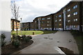
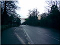
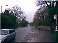
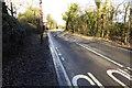
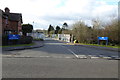
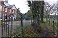
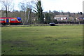
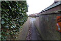

50 photos from this area
Area Information
Key information about the TW20 9PS including its size, population, and administrative classification.
- Area Type
- Postcode
- Area Size
- 1.4 hectares
- Population
- 1872
- Population Density
- 6282 people/km²
House Prices in TW20 9PS
34
Properties
£235,333
Average Sold Price
£91,500
Lowest Price
£395,000
Highest Price
Showing 34 properties
| Address | Type | Beds | Baths | Last Sale Price | Last Sale Date | |
|---|---|---|---|---|---|---|
| 70 Spring Rise, Egham, TW20 9PS | Semi-detached | 3 | 1 | £292,000 | Jan 2023 | |
| 72 Spring Rise, Egham, TW20 9PS | Semi-detached | 2 | 1 | £300,000 | Nov 2022 | |
| 98 Spring Rise, Egham, TW20 9PS | Bungalow | 2 | - | £395,000 | Jan 2015 | |
| 38 Spring Rise, Egham, TW20 9PS | Semi-detached | 4 | 2 | £280,000 | Jun 2010 | |
| 54 Spring Rise, Egham, TW20 9PS | Semi-detached | 3 | 1 | £235,000 | Jan 2007 | |
| 40 Spring Rise, Egham, TW20 9PS | Semi-detached | 4 | 1 | £233,000 | Mar 2005 | |
| 36 Spring Rise, Egham, TW20 9PS | Semi-detached | - | - | £165,000 | May 2000 | |
| 96 Spring Rise, Egham, TW20 9PS | Detached | - | - | £126,500 | Jul 1998 | |
| 48 Spring Rise, Egham, TW20 9PS | Semi-detached | 2 | 1 | £91,500 | Apr 1998 | |
| 34 Spring Rise, Egham, TW20 9PS | Semi-detached | 4 | 1 | - | - |
Page 1 of 4
Energy Efficiency in TW20 9PS
Amenities
Schools
| Rank | School | Type | Entry gender | Ages |
|---|
Explore more schools in this area
Go to Schools tabDemographics
Household Size
Family (3-5 people)
most common
Accommodation Type
Houses
most common
Tenure
48
majority
Ethnic Group
White
most common
Religion
N/A
most common
Household Composition
N/A
most common
Age
22
median
Young Adults (15-29 years)
most common
Household Deprivation
N/A
with no deprivation
NS-SEC
29
in Lower managerial occupations
Explore more demographic insights in this area
Go to Demographics tabPlanning
Planning Constraints
- Flood RiskPremium
- Ramsar Wetland SitesPremium
- Area of Outstanding Natural BeautyPremium
- Protected Nature ReservePremium
- Protected WoodlandPremium