Area Overview for TW20 9NQ
Photos of TW20 9NQ
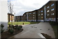
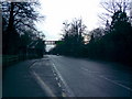
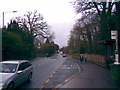
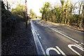


50 photos from this area
Area Information
Key information about the TW20 9NQ including its size, population, and administrative classification.
- Area Type
- Postcode
- Area Size
- 5.7 hectares
- Population
- 1545
- Population Density
- 2603 people/km²
House Prices in TW20 9NQ
25
Properties
£526,292
Average Sold Price
£207,500
Lowest Price
£850,000
Highest Price
Showing 25 properties
| Address | Type | Beds | Baths | Last Sale Price | Last Sale Date | |
|---|---|---|---|---|---|---|
| 45 Manor Way, Egham, TW20 9NQ | Detached | 4 | 1 | £850,000 | Jan 2025 | |
| 43 Manor Way, Egham, TW20 9NQ | house | - | - | £673,000 | May 2021 | |
| 39 Manor Way, Egham, TW20 9NQ | house | 3 | 1 | £640,000 | Jan 2021 | |
| 41 Manor Way, Egham, TW20 9NQ | Semi-detached | 3 | 1 | £642,500 | Aug 2020 | |
| 21 Manor Way, Egham, TW20 9NQ | Semi-detached | 3 | 1 | £595,000 | Feb 2020 | |
| 5 Manor Way, Egham, TW20 9NQ | Semi-detached | 3 | 3 | £610,000 | Aug 2018 | |
| 23 Manor Way, Egham, TW20 9NQ | Semi-detached | 3 | 1 | £587,500 | Jul 2017 | |
| 3 Manor Way, Egham, TW20 9NQ | house | - | - | £485,000 | Apr 2015 | |
| 1 Manor Way, Egham, TW20 9NQ | house | - | - | £410,000 | Dec 2011 | |
| 15 Manor Way, Egham, TW20 9NQ | Semi-detached | - | - | £370,000 | Apr 2007 |
Page 1 of 3
Energy Efficiency in TW20 9NQ
Amenities
Schools
| Rank | School | Type | Entry gender | Ages |
|---|
Explore more schools in this area
Go to Schools tabDemographics
Household Size
Family (3-5 people)
most common
Accommodation Type
Houses
most common
Tenure
62
majority
Ethnic Group
White
most common
Religion
N/A
most common
Household Composition
N/A
most common
Age
22
median
Young Adults (15-29 years)
most common
Household Deprivation
N/A
with no deprivation
NS-SEC
29
in Lower managerial occupations
Explore more demographic insights in this area
Go to Demographics tabPlanning
Planning Constraints
- Flood RiskPremium
- Ramsar Wetland SitesPremium
- Area of Outstanding Natural BeautyPremium
- Protected Nature ReservePremium
- Protected WoodlandPremium