Area Overview for TW20 9JL
Photos of TW20 9JL
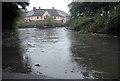


100 photos from this area
Area Information
Key information about the TW20 9JL including its size, population, and administrative classification.
- Area Type
- Postcode
- Area Size
- 3858 m²
- Population
- 1538
- Population Density
- 3471 people/km²
House Prices in TW20 9JL
12
Properties
£351,613
Average Sold Price
£195,000
Lowest Price
£578,000
Highest Price
Showing 12 properties
| Address | Type | Beds | Baths | Last Sale Price | Last Sale Date | |
|---|---|---|---|---|---|---|
| 9 Caddy Close, Egham, TW20 9JL | house | - | - | £578,000 | Oct 2022 | |
| 6 Caddy Close, Egham, TW20 9JL | Detached | 4 | 2 | £500,000 | Jan 2019 | |
| 4 Caddy Close, Egham, TW20 9JL | Detached | 5 | 2 | £395,000 | Jul 2015 | |
| 1 Caddy Close, Egham, TW20 9JL | Detached | 1 | 1 | £350,000 | Jun 2009 | |
| 2 Caddy Close, Egham, TW20 9JL | Detached | 6 | 2 | £299,950 | Jun 2004 | |
| 11 Caddy Close, Egham, TW20 9JL | Semi-detached | - | - | £289,950 | Mar 2004 | |
| 3 Caddy Close, Egham, TW20 9JL | Detached | - | - | £195,000 | Nov 2001 | |
| 8 Caddy Close, Egham, TW20 9JL | Detached | 4 | 2 | £205,000 | Nov 2000 | |
| Side Flat, 1 Caddy Close, Egham, TW20 9JL | Flat | - | - | - | - | |
| 5 Caddy Close, Egham, TW20 9JL | Semi-detached | - | - | - | - |
Page 1 of 2
Energy Efficiency in TW20 9JL
Amenities
Schools
| Rank | School | Type | Entry gender | Ages |
|---|
Explore more schools in this area
Go to Schools tabDemographics
Household Size
One person
most common
Accommodation Type
Flats
most common
Tenure
39
majority
Ethnic Group
White
most common
Religion
N/A
most common
Household Composition
N/A
most common
Age
47
median
Adults (30-64 years)
most common
Household Deprivation
N/A
with no deprivation
NS-SEC
36
in Lower managerial occupations
Explore more demographic insights in this area
Go to Demographics tabPlanning
Planning Constraints
- Flood RiskPremium
- Ramsar Wetland SitesPremium
- Area of Outstanding Natural BeautyPremium
- Protected Nature ReservePremium
- Protected WoodlandPremium